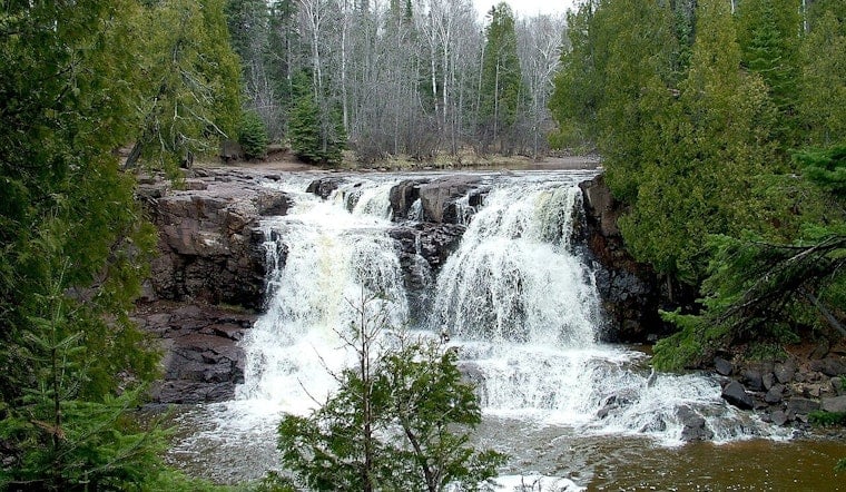
Spring snowmelt teamed up with a hefty round of rain and turned the Gooseberry River into a raging chute, sending normally calm overlooks into foamy whitewater and swallowing stretches of boardwalk. Riverside trails at Gooseberry Falls State Park are now closed, and warning signs are up after crews found parts of the lower loop underwater. Drivers cruising the North Shore are being told to expect limited access along Highway 61 between Two Harbors and Split Rock Lighthouse and to line up backup stops along the way.
State Park Locks Down Riverside Trails
The Minnesota Department of Natural Resources said Friday that the mix of snowmelt and recent rain has left trails along the Gooseberry River “currently inaccessible” and urged visitors not to try wading through flooded sections, according to CBS Minnesota. Photos and short video from the agency show water roaring through the gorge and spilling over the boardwalks, prompting staff to rope off overlooks until levels drop back to something resembling normal.
Flood Watches and Surging River Levels
The National Weather Service office in Duluth issued flood advisories along with a Flood Watch for parts of Cook and Lake counties as area streams and rivers swelled during the spring melt, warning about localized flooding in low-lying spots, according to the National Weather Service. Local coverage has also noted that several North Shore rivers jumped multiple feet during the thaw and recent storms, boosting the hazards around waterfalls and riverside paths across the region, per Bring Me The News.
What Visitors Can Expect and How to Stay Safe
Gooseberry Falls is one of Minnesota’s busiest state parks; the Star Tribune reported it saw more than 750,000 visitors in 2024, so river closures are expected to ripple through weekend traffic and sightseeing plans. Park staff are telling campers and hikers to call ahead to get the latest on what is open, and local outlets report that some campsites still hold pockets of snow while certain campground facilities are limited this season, according to WDIO.
Why the North Shore Is Extra Vulnerable This Spring
Officials say a lingering late-season snowpack paired with on-and-off storm systems pushed spring runoff beyond what the shore typically sees, a setup that has fueled high water and trail damage up and down the coastline, according to MPR News. State park crews and county road teams are watching gauges and checking for erosion or infrastructure problems as river flows slowly back off.
Park officials and the National Weather Service both note that conditions can flip fast, so anyone headed for the North Shore is urged to check the DNR park page and current forecasts before rolling out, to avoid unexpectedly closed trails and dangerous whitewater. For photos and on-the-ground updates, see coverage from CBS Minnesota along with the DNR’s posted conditions.


