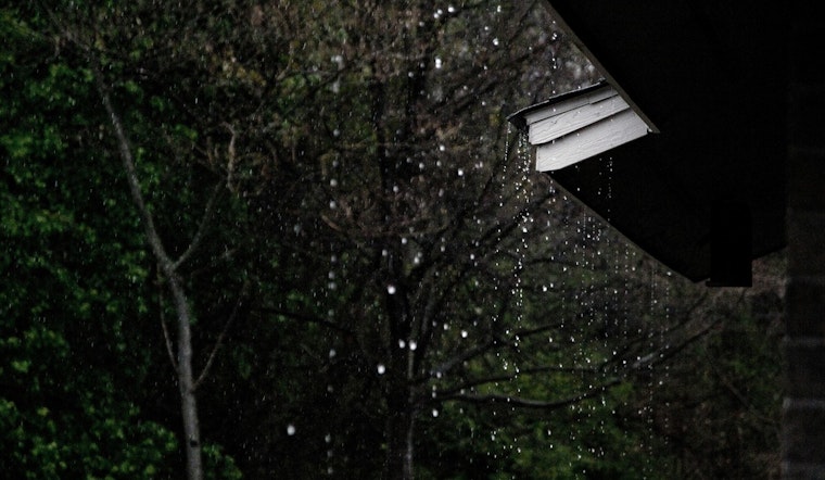
Seattle wakes up to another gray, soggy start on Wednesday, May 13, 2026, with cloudy skies, light rain and morning temperatures hovering around 54°F. Showers are expected to hang around through much of the morning, with highs near 62°F and a breezy south-southwest wind lining up for the afternoon. Plan on wet roads, slower traffic and a few heavier bursts of rain during the morning drive.
What To Expect Today
Rain is likely through the morning and into the early afternoon, with most neighborhoods seeing light, steady showers and about a 70–80% chance of measurable precipitation. Temperatures should peak near 62°F, then ease back into the low 60s later in the day as southerly winds pick up. According to the National Weather Service, new rainfall totals look modest, generally under one tenth of an inch for most of the city, although a few spots could collect a few tenths.
Afternoon Winds Pick Up
Through the afternoon, winds will swing around to the south-southwest and strengthen, with sustained speeds mostly in the teens and gusts in the 20–25 mph range for more exposed locations. The bluster will be most noticeable near the waterfront, over bridges and along the Ship Canal, where bicyclists and drivers of smaller vehicles will want a firm grip on the handlebars or steering wheel. It is also a good time to secure anything loose on balconies or patios, since stronger gusts could send lightweight furniture or décor tumbling.
Boaters Take Note
A Small Craft Advisory remains in effect for parts of the central U.S. waters and the northern inland waters, including the San Juan Islands, through tonight. Smaller vessels are advised to stay in port or stick to very sheltered waters. Onshore southerly winds will kick up choppy seas and make launch conditions tricky, especially for less experienced mariners. Anyone who absolutely has to head out should check local launch conditions and tide tables carefully before leaving the dock.
Weekend Outlook
Another system is expected to move in on Friday, May 15, 2026, keeping the region unsettled into Saturday, May 16, 2026. Friday’s highs should land near 57°F, with the best chance for heavier showers and isolated thunderstorms coming late Saturday. The Cascades are favored for most of the thunder, but the lowlands could still see a stray afternoon storm. Local coverage also highlights the risk for thunderstorms and gusty conditions. See KIRO 7 for more detail on timing and potential impacts.
How To Plan
For today, a rain jacket, waterproof shoes and an umbrella are smart choices, along with a little extra time for the commute on slick streets and bridges. If you have outdoor plans on Saturday, consider scheduling them earlier in the day or keeping a backup option in your pocket in case showers or storms roll through. Keep an eye on updated forecasts and check the National Weather Service or local broadcasters periodically for the latest changes.


