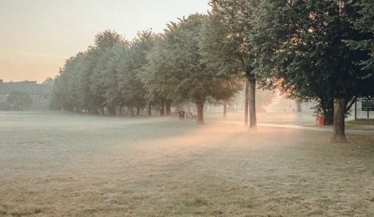
Charlotte woke up to thick, soupy air and pockets of dense fog Thursday morning, with temperatures stuck near 72°F and dewpoints hovering close to 70°F. Mostly sunny skies later today should boost highs into the mid 80s, around 86°F, before a weak backdoor front slips through late in the day.
Afternoon Storms Mostly North
A few pop-up showers and thunderstorms could fire Thursday afternoon, but most of the real action is expected to stay north of the city toward the Upstate, so many neighborhoods may get away with a dry day. The National Weather Service keeps the severe threat on the low side, although a rogue stronger cell cannot be completely ruled out.
Weekend Snapshot
Rain chances return for the weekend, with Saturday shaping up as the soggiest day and highs holding in the upper 70s. The most widespread rain looks possible from midday into early afternoon, so have a Plan B ready if you are counting on park time or patio brunch. For local context on the stubborn frontal setup, see our earlier coverage on soupy morning fog.
Saturday Timing And What Comes Next
Showers and thunderstorms are most likely Saturday morning through early afternoon, with highs near 79°F before drier air starts to filter in. The National Weather Service is calling for about a 70% chance of rain Saturday, followed by a noticeable trend toward drier conditions as we head into early next week.
Foggy Mornings, Plan Ahead
Low-lying spots could see patchy dense fog through Friday mornings, so budget a few extra minutes for early commutes and watch for sudden drops in visibility over bridges and elevated roadways. There are no watches or warnings in effect for Charlotte right now, but brief downpours from slow-moving storms could quickly cut visibility and make roads slick.
Check an hourly radar loop before heading out and keep a compact umbrella within reach for Saturday plans. We will update this forecast if conditions change.


