Wednesday, May 20, 2026, started out partly cloudy and muggy in Jacksonville, with early morning temperatures near 72°F and a daytime high expected around 88°F. East to southeast winds are set to ramp up through the afternoon to roughly 3–15 mph with gusts near 23 mph, keeping the coastline choppy and inland neighborhoods on the sticky side. Inland lowlands should watch for patchy, locally dense fog before sunrise, especially near the I‑10 corridor.
Afternoon Winds Pick Up
As the sea breeze pushes inland this afternoon, it will punch up the east winds, with the highest gusts hitting exposed beaches and waterfront bridges. Those gusts could spell trouble for small craft and any loose backyard gear, so it is a good idea to bring in umbrellas and tie down lightweight furniture, according to National Weather Service Jacksonville.
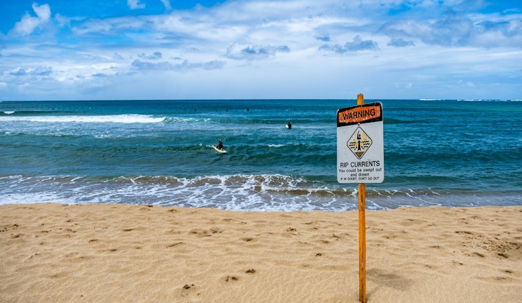
Beaches And Rip Currents
Area beaches are under a moderate rip current risk through Friday, and the mix of surf and onshore winds could make things rougher as the holiday weekend approaches. Lifeguards are urging swimmers to stay close to staffed towers and to follow posted flag warnings. For more recent context, see our May 19 update on how rip currents roil local beaches.
Foggy Mornings, Sunny Afternoons
Overnight lows should settle in the lower 70s along the coast and the upper 60s to lower 70s inland, a setup that favors patchy fog before dawn in sheltered valleys and river corridors. Afternoons are expected to run mostly sunny, with highs in the upper 80s to near 90°F inland, and a growing chance of isolated afternoon showers or storms later this week as humidity continues to climb.
Plan outdoor time for the warm, mostly dry afternoons, keep an eye on radar during peak sea breeze hours after 2 p.m., and always check lifeguard flags before heading into the water this weekend.


