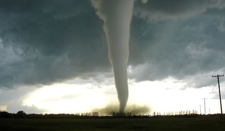
A fast-developing line of rotating storms put parts of southwest Wisconsin on edge Wednesday evening, as a tornado warning lit up northwestern Iowa County and watches spread across neighboring counties. Forecasters warned that the storms could whip up flying debris, damage roofs and vehicles, and pose a serious threat to anyone caught outside or in mobile homes.
What the National Weather Service warned
According to the National Weather Service, the tornado warning for northwestern Iowa County was in effect until 6:45 p.m. CDT, with radar indicating rotation in a storm tracking toward Dodgeville. The warning stressed that flying debris could be dangerous for anyone without shelter and that mobile homes could be damaged or destroyed.
Tornado watch covers several counties
The Storm Prediction Center listed Tornado Watch 346 as active until 9 p.m. CDT for parts of south-central and southwest Wisconsin, including Dane, Green, Iowa and Lafayette counties. A watch means conditions are favorable for tornadoes and other severe thunderstorms to develop.
Safety steps and driving guidance
Officials urged residents to move to an interior room on the lowest floor of a sturdy building and to stay away from windows, per the National Weather Service. Drivers caught on the road during a warning were advised to seek shelter in a substantial building or, only as a last resort, lie flat in a low area and cover their head.
Where storms were spotted and what to watch
The Milwaukee Journal Sentinel reported radar-indicated rotation near Boscobel and Muscoda and noted that some storms were moving east at roughly 35 to 45 mph, with the potential to reach Dodgeville in the early evening. The outlet listed several communities under the broader watch, including Dodgeville, Mineral Point, Monroe and Madison, and urged residents to stay tuned to local alerts.
Where to get updates
For the latest watches and warnings, check the Storm Prediction Center and your local National Weather Service office for updates and any post-storm surveys. Local radio, emergency alert systems and official NWS products remain the go-to sources for rapidly changing conditions.


