

























































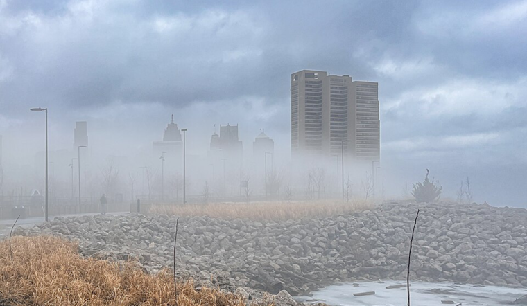
Detroit rolled out of bed under pockets of patchy fog this morning, but the gloomy start will not last long. The haze should lift quickly, setting the stage for a hot afternoon with highs near 90°F across the metro area. Light southwest winds and muggy air will keep overnight lows stuck in the upper 60s to around 70°F. Eyes then turn to late week timing, as a front is expected to bring a better shot at showers and thunderstorms tomorrow into tomorrow night.
Foggy Morning, Sunny Afternoon
Areas of fog should thin out before about 9 a.m., giving way to mostly sunny skies and full daytime heating by midday. Southwest winds will be light, at roughly 0 to 8 mph, so there will not be much of a breeze to take the edge off once temperatures climb.
Thursday Storms Could Bring Heavy Rain And Gusts
A cold front arriving tomorrow brings a 60% chance of showers and thunderstorms into the region, with the best coverage expected during the afternoon and evening. Forecasters note that some storms could produce isolated damaging wind gusts and locally heavy downpours, and slow-moving clusters may drop half an inch to an inch or more of rain in spots, leading to ponding on city streets. According to the National Weather Service Detroit, isolated damaging wind gusts and locally heavy rainfall remain the primary hazards.
Impacts For Commuters And Outdoor Plans
Morning fog will cut visibility for early drivers, so low beams and extra following distance are a smart move for the commute. If you have outdoor events lined up tomorrow into tomorrow night, you will want a solid indoor backup plan, since storms can build quickly and arrive with gusty winds and brief heavy rain. After the front, temperatures head back into the upper 80s and lower 90s early next week (July 13 and 14), so factor in hydration breaks and shade for any prolonged time outside.
Where To Get Updates
Keep weather alerts enabled on your phone and refresh forecasts if you have travel or evening plans, since details can shift as the front approaches. For official forecasts and any watches that may be issued, visit the National Weather Service Detroit, and check local traffic outlets for storm-related slowdowns or street flooding.





