

























































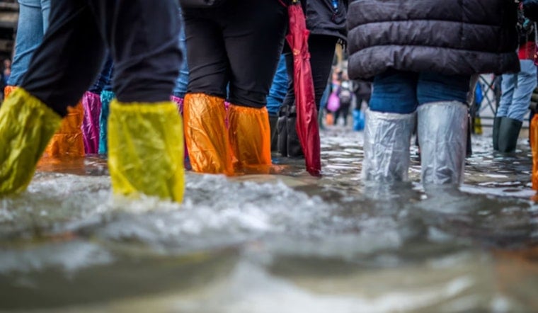
Philadelphia is bracing for another soaking as emergency managers warn that repeated rounds of heavy thunderstorms could trigger dangerous flash flooding across the city. On Monday evening, the Office of Emergency Management urged residents to stay off flooded roads and reminded drivers that even shallow, fast-moving water can be enough to sweep a car away. With radar showing storms lining up over already saturated ground, city crews and transit agencies were put on alert and residents were asked to check official channels before heading out.
What The National Weather Service Is Warning
The National Weather Service office in Mount Holly has placed much of the Philadelphia region under a Flood Watch starting Tuesday morning and continuing into Wednesday afternoon, with localized flash flood warnings already issued Monday as storms rolled through. Forecasters are calling for rainfall rates of 1 to 2 inches per hour, with some spots seeing 2 to 4 inches of total rain, high enough to swamp urban drainage systems and small streams, according to the National Weather Service. Meteorologists added that training storms, where heavy cells move repeatedly over the same area, could send creeks up fast and flood out streets in a hurry.
City Response And OEM Advisory
The Philadelphia Office of Emergency Management pushed out the alert on Facebook Monday evening, leaning on a familiar piece of life-saving advice: do not drive through flooded roads. The post directed residents to sign up for ReadyPhila alerts and asked people to report hazards so city crews can respond, according to the Office of Emergency Management. OEM said teams are watching known trouble spots for flooding and coordinating with public works and transit partners as storms line up.
Where The Heaviest Rain Could Fall
Local reporting has flagged July as an unusually soggy month in Philadelphia, with more than six inches of rain already measured at Philadelphia International Airport and more on the way. The next rounds of storms could be the heaviest yet this week. The Philadelphia Inquirer highlighted the flood watch and noted that localized flash flooding and even isolated tornadoes are possible where storms train over saturated ground, according to The Philadelphia Inquirer. That combination sets the stage for quick rises on urban streets, underpasses and smaller creeks.
How To Stay Safe
City guidance leans on simple, practical steps. Do not try to drive through standing water, move your vehicle to higher ground if your block is known to flood, and steer clear of underpasses and low-lying streets when storms hit. For preparedness checklists, cleanup tips and information on how to report non-emergencies, the city posts resources and the ReadyPhila alert sign-up on its emergency pages, according to the City of Philadelphia. For life-threatening situations, officials say to call 911, and to report hazards like downed wires to 311 or the appropriate utility emergency line.
Commuters should be ready for delays during the most intense storms and consider alternate routes as local traffic and weather teams share live maps of flooded streets. Broadcasters and traffic monitors have advised that drivers delay nonessential trips while warnings are active, according to 6abc Action News. Officials say they will update advisories as radar and river gauge data come in.
Before you head out, check official alerts and local forecasts, and keep one rule in mind: turn around, do not drown. If your neighborhood is prone to flooding, move cars to higher ground and have a plan to shelter safely if water starts to rise. Officials are expected to keep pushing updates as conditions change and more information becomes available.





