

























































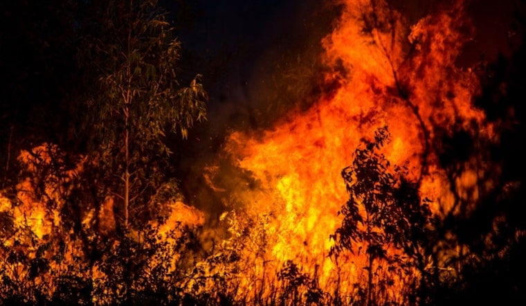
A wildfire burning east of Mountain Ranch has forced evacuations in Calaveras County, with crews reporting that the blaze is throwing embers ahead of its main perimeter and igniting small spot fires as it grows. The Lome Fire was estimated at about 10 to 15 acres Thursday and is spreading at a moderate rate, according to CAL FIRE.
Evacuations are underway near Old Emigrant Trail and Swiss Ranch Road, according to CBS Sacramento, which first reported on the fire Thursday. County officials confirmed evacuations are underway in Calaveras County as the fire burns just east of the unincorporated community. CAL FIRE's Tuolumne-Calaveras Unit is managing the response, reporting the fire's acreage and its moderate spread rate.
Evacuation Order Covers Zone CCU-043
A Genasys map shows an evacuation order has been issued for Zone CCU-043 in Calaveras County. The county relies on the Genasys Protect platform, formerly known as Zonehaven, to designate pre-established evacuation zones like CCU-043, a system the Board of Supervisors adopted unanimously as part of the county's Emergency Operations Plan Evacuation Annex in October 2024, according to the Calaveras Planning Coalition. The annex standardized traffic management and emergency notification systems countywide, giving residents a consistent zone-based framework to check for evacuation status during fast-moving incidents like this one.
Crews are contending with short-range spot fires, a tactical challenge that occurs when thermal updrafts and wind carry burning embers ahead of a wildfire's main perimeter, igniting new spot blazes in dry vegetation that can jump containment lines and accelerate the fire's spread. That spotting behavior often forces firefighters to pivot from direct attack to ember control, slowing efforts to box in the flames even on a fire still measured in single-digit acreage.
A Community Still Marked By 2015
Mountain Ranch is an unincorporated Gold Country community of roughly 1,600 residents sitting at about 2,123 feet elevation, with most households scattered across rural acreage outside the historic town center. The community carries deep historical sensitivity around wildfire evacuations: in September 2015, Mountain Ranch was heavily impacted by the Butte Fire, which burned 70,868 acres across Calaveras and Amador counties, destroyed more than 800 structures, and killed two Mountain Ranch residents who had refused evacuation orders, according to the Los Angeles Times.
Primary local wildland fire protection in the area comes from the Central Calaveras Fire and Rescue Protection District, backed by CAL FIRE's Esperanza Forest Fire Station located about a mile east of Mountain Ranch within the Tuolumne-Calaveras Unit's West Point Battalion. That unit maintains direct wildland fire protection responsibility over more than 1 million acres of State Responsibility Area spanning Calaveras, Tuolumne, eastern Stanislaus, and eastern San Joaquin counties, per background compiled on Wikipedia.
A County Already Stretched Thin
The Lome Fire arrives after a punishing stretch for Calaveras County firefighting resources. Earlier in August, the county's Gann Fire burned nearly 6,500 acres and prompted Calaveras County Sheriff Rachelle Whiting to proclaim a local state of emergency to secure state assistance, as Hoodline previously reported. Just weeks before that, CAL FIRE TCU crews spent late July and early August fighting the 223-acre Dove Fire near Sonora in neighboring Tuolumne County, which damaged or destroyed 14 structures before reaching full containment and resulted in arson charges against a local resident.
The region's fire risk has also been compounded by standing restrictions. CAL FIRE's Tuolumne-Calaveras Unit suspended all outdoor residential open burning permits for Zone 1 areas below 3,500 feet elevation back in May 2025 due to rapidly increasing seasonal wildfire danger, a ban covering State Responsibility Areas across Calaveras, Tuolumne, Stanislaus, and San Joaquin counties. Property owners in those state-protected zones are also legally required under California Public Resources Code Section 4291 to maintain 100 feet of defensible space around homes, with CAL FIRE peace officers authorized to issue citations and escalating fines, up to misdemeanor charges, for uncorrected vegetation hazards.
The Lome Fire remains a developing situation, and it is not yet known whether the spot fires reported near Swiss Ranch Road have breached secondary containment lines or whether structure protection units have been dispatched to homes inside Zone CCU-043. Residents in the affected area are urged to monitor official evacuation zone updates as crews continue working to slow the fire's spread.



