

























































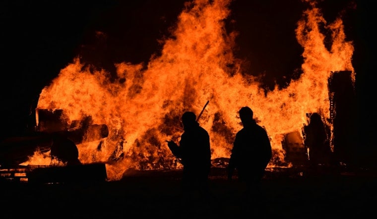
A wildfire burning in one of the most remote corners of Washoe County has grown to 9,524 acres and remains just 5% contained, threatening a residential building and two outbuildings near the ghost town of Vya. The S-1 Vya Fire ignited at 1:59 p.m. on August 24, and crews are now racing against gusty winds and bone-dry humidity to keep it from spreading further north.
The fire has already impacted three structures in northern Washoe County and continues to directly threaten one residential building and two outbuildings, according to 2 News Nevada. As reported by the Sacramento Bee, the blaze is burning through grass, brush and timber and is managed by the BLM Northern California District, with roughly 300 firefighters assigned to the response as of Thursday morning. The fire's cause remains under investigation.
Washoe County has issued evacuations in the area of the fire, and a temporary flight restriction is in effect overhead, per InciWeb reporting cited by the Sacramento Bee. Authorities have also closed roads at the intersection of County Road 34 and County Road 8A, as well as at Barrel Springs Road and Mosquito Road, to keep non-emergency traffic out of the fire zone, according to 2 News Nevada. Those unpaved county roads serve as primary transit corridors through the isolated high-desert rangeland near the California and Oregon borders.
Crews Cut Lines as Winds Threaten to Push Fire North
On Thursday, firefighters prioritized defensive engine operations, clearing flammable brush around threatened structures and cutting holding lines to build defensible space as the fire risked pushing farther north, 2 News Nevada reports. Southwest winds are forecast to gust between 25 and 35 mph, with gusts up to 40 mph possible in wind-prone areas, and afternoon relative humidity is expected to drop to just 10-20%, according to InciWeb data relayed by the Sacramento Bee. InciWeb has also reported that elevated to locally critical fire weather is expected across northeastern California and northwestern Nevada.
There is a glimmer of hope for crews: Friday precipitation chances are forecast at roughly 40-80%, per InciWeb. Containment at 5% means that just a twentieth of the fire's perimeter is surrounded by a control line, leaving the remaining 95% uncontrolled — containment figures do not mean a fire is out.
The blaze arrived escalated enough that a Complex Incident Management Team was ordered to assume command and provide enhanced management capacity, according to InciWeb incident reports published by Wildfire Explorer. Complex Incident Management Teams are specialized interagency units brought in when a wildland fire outpaces the capacity of local initial-attack crews.
A Ghost Town's Last Structures at Risk
Vya itself is largely a memory. The unincorporated Washoe County community was founded around 1910 under the Enlarged Homestead Act and was mostly abandoned during the 1920s after severe drought and crop failures, according to historical records from Nevada Expeditions. Only two historic wooden buildings — the former post office and library — remain from the original settlement, underscoring why the current threat to a residential building and outbuildings carries added weight for local history.
The fire area also borders the Massacre Rim Wilderness Study Area, which DarkSky International designated an International Dark Sky Sanctuary in 2019 for its remoteness and near-total absence of light pollution. Massacre Rim spans more than 100,000 acres of public land in far northern Washoe County, making it one of the darkest, most pristine landscapes in the contiguous United States.
A County Already Stretched Thin
The S-1 Vya Fire ignited amid an extraordinarily severe wildfire surge across Washoe County this month. It follows the 93,733-acre Bug Fire, which started August 8 and caused one civilian burn fatality as it burned across Washoe, Lassen and Sierra counties, according to CAL FIRE incident records. Hoodline covered that blaze's rapid spread as it forced Cold Springs and Silver Knolls residents to flee earlier this month.
Nevada Governor Joe Lombardo declared a state of emergency for Washoe County in late August as multiple major blazes, including the human-caused, 15,085-acre Hawk Fire in northwest Reno, forced tens of thousands of residents to evacuate, according to Emergency Washoe. The Hawk Fire destroyed dozens of homes near Peavine Mountain, a crisis Hoodline detailed in its report on the governor's emergency declaration.
That county-wide strain is unfolding against a backdrop of extreme national fire activity. Nationwide wildfire activity has reached maximum Preparedness Level 5, with 51,295 wildfires having burned over 7.9 million acres — 165% of the 10-year national average — according to National Interagency Fire Center metrics reported by Wildfire Explorer. That designation means firefighting personnel and air assets nationwide are nearly fully committed, raising questions about how much additional support the incoming management team can secure for the Vya Fire given competing priorities elsewhere in the region.
Wildlife Habitat Also at Stake
Beyond structures and history, the fire threatens sensitive sagebrush habitat relied on by greater sage-grouse. A 2023 U.S. Geological Survey study published in Scientific Reports found that wildfires in northwestern Nevada cause immediate and lasting reductions in adult and nest survival rates for the species by destroying sagebrush cover. Sage-grouse populations across the Great Basin have declined by as much as 80% since 1965, according to the same research.
For now, fire managers are watching the forecast as closely as the flames. Whether Friday's rain chances materialize in time to blunt the fire's push northward — before more structures or habitat are lost — remains an open question as crews continue building containment lines through the weekend.



