

























































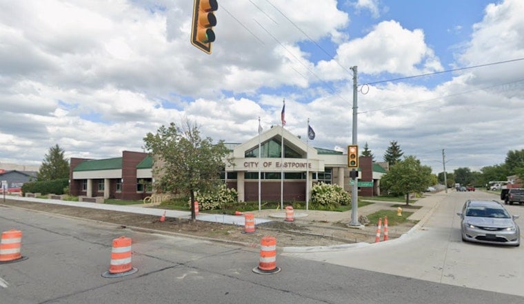
Eastpointe officials got their first formal look last Tuesday at a feasibility study for a proposed greenway that would stitch together four Macomb County communities into a single non-motorized corridor stretching from Warren to Lake St. Clair. Eastpointe Economic Development Manager Ian McCain presented the Stephens Road Greenway feasibility study to the Eastpointe City Council last Tuesday at Eastpointe City Hall, making Eastpointe the first of the four partner communities to receive the formal presentation.
A Corridor Eight Segments Long
The proposed corridor consists of eight segments and is still in its first phase, according to MLive. The full route runs from Van Dyke Avenue in Warren to Little Mack Avenue in St. Clair Shores, linking Warren, Center Line, Eastpointe and St. Clair Shores, as C & G Newspapers reported in March. Eastpointe contains the longest portion of the proposed corridor, with segments five through eight running through the city and connecting Belleview Elementary, Eastpointe High School, the Michigan Military Technical and Historical Society, Kennedy Memorial Park, Spindler Park, Forest Park Elementary, Eastpointe Middle School, Roxanna Park and Shamrock Park.
On the eastern end, the trail would provide access to the St. Clair Shores Civic Arena, local schools and Lake St. Clair itself. Center Line City Manager Dennis Champine has said the corridor was chosen because no continuous non-motorized pathway previously existed to link residents in western Macomb County directly to the lake, the same outlet reported. The proposed greenway would also connect to Michigan's Iron Belle Trail, a state-designated system that stretches more than 2,000 miles from Belle Isle in Detroit to the western tip of the Upper Peninsula and is roughly 71% complete, according to the state.
Money Still the Missing Piece
The feasibility study itself contains only recommendations, not construction commitments, and the four cities cannot fund the project independently. The Southeast Michigan Council of Governments used its planning assistance program to fund the study, and the coalition depends on external grants to move forward, including potential support from the Ralph C. Wilson, Jr. Foundation and the Michigan Department of Transportation. The Wilson foundation announced a $100 million commitment in October 2018 dedicated to expanding and maintaining parks, trails and greenways across Southeast Michigan, with $50 million of that earmarked specifically for regional trail networks, as reported by WDET.
Whatever construction dollars eventually materialize will come with strings attached. Under Michigan law, local governments seeking development or land acquisition grants from the Michigan Natural Resources Trust Fund must provide at least a 25% local financial match. SEMCOG's own planning assistance grants required a non-federal local cash match of roughly 18% to 20% of total project costs, per the agency's program documentation — and the feasibility study itself uses an 85-15 funding split, with Eastpointe contributing the largest local match among the four cities.
Split Opinions at the Public Meetings
Public engagement so far has included three stakeholder meetings, seven steering committee meetings and two community workshops, with officials saying residents will have multiple opportunities to weigh in as the project moves forward. An early community survey drew 642 responses to an online survey, per MLive, while a related tally reported by C & G Newspapers found 602 responses, with roughly two-thirds of respondents saying they strongly supported the project, per McCain, even though 81% said they had not previously heard of the proposal before taking the survey.
Not everyone at the table is sold. One resident raised concerns about potential tax burdens and increased police patrols tied to the greenway, while resident Harvey Curley asked whether street parking would be removed along the corridor. No decisions on street parking removal have been made, and there are no definitive trailhead plans yet, though a vacant former gas station at Gratiot Avenue and Stephens Road in Eastpointe has been floated as a possible location — one that could accommodate a bicycle repair station and benches.
What Supporters Say It Could Bring
Backers of the project describe it as more than a walking path. City officials say the greenway would expand active transportation options for residents, serve as a recreational resource, and function as an economic development tool that could raise nearby property values and increase business patronage along the corridor. The proposed design includes shared-use paths, improved pedestrian crossings, and landscaping and placemaking elements meant to knit the route into each city's existing streetscape.
Warren has already folded the corridor concept into its own planning, having completed an Active Mobility Plan using GIS mapping and street design models to identify non-motorized gaps along arterial roads like Stephens Road, according to The Greenway Collaborative. Eastpointe's updated 2025–2026 Master Plan similarly prioritizes non-motorized transportation corridors and economic development along major streets to guide capital investment over the next 17 years, according to city planning documents. The feasibility study is scheduled to be presented to the Warren, Center Line and St. Clair Shores city councils later this month, and additional planning, engineering and funding will be required before any shovels go into the ground.





