

























































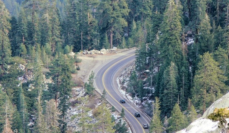
U.S. Highway 50 in western El Dorado County is California's hotspot for collisions with deer, a 2026 UC Davis report finds. On major paved roads and highways, the same analysis estimates that vehicles kill about 44,000 mule deer a year, nearly 10% of the population, and at least 780 mountain lions, about 18% of the state's lions.
The count is already large, and it is not the whole map. The Road Ecology Center's 13th annual overview of wildlife-vehicle conflict covers only about half the roads for which researchers have information, so the actual toll is likely higher. UC Davis put the western El Dorado stretch of Highway 50 at the top of the deer list anyway.
A Count Built On Half The Roads
The California Roadkill Observation System behind the work holds 235,000 records, spanning 77 amphibian, 388 bird, 112 reptile and 193 mammal species. Deer and mountain lions are the numbers that travel, but the dataset is a much wider ledger of what traffic hits.
Researchers were explicit that the paved-road estimates leave out roughly half the state's roads. They did not put a number on the missing share. The useful reading is the one they did give: about 44,000 mule deer and at least 780 mountain lions a year are floors, not ceilings.
A year earlier, the center's 2024 report found a decline in mule deer roadkill and said that suggested a decline in the statewide deer population. Fewer carcasses can mean fewer animals, not safer pavement. The 2026 hotspot ranking does not cancel that suggestion. It says a smaller herd can still meet a very busy highway in the same places.
The Same Foothill Stretch, Year After Year
Western El Dorado County is productive deer habitat, and herds still try to migrate through the foothills. Fraser Shilling, whose center produced the report, has said wild animals do not instinctively avoid roads. Deer moving through that country meet Highway 50 whether or not a driver is watching the shoulder.
The pattern is not new. A 2017 study, limited to animal-related incidents reported to the California Highway Patrol, counted 245 wildlife collisions over 54 miles of Highway 50 in El Dorado County. The same study ranked Highway 174 in Nevada County fifth, with 75 collisions over 11 miles. Those were reported crashes, not every animal that died off the shoulder and never generated a CHP record.
The Sacramento Bee, drawing on the 2026 report, identified Highway 50 between the Sacramento-El Dorado county line and Cameron Park as one of California's longest-running deer-collision hotspots. Six highway corridors statewide had consistently high rates of large-mammal collisions for 10 consecutive years, from 2016 through 2025. The foothill commute and the migration overlap on a road that has already had a decade to prove it is not a fluke.
A Crossing Without A Fence Is A Door
UC Davis's report treats fencing, not a wildlife crossing by itself, as the only known way to lower roadkill rates aside from cutting traffic volumes, speeds or the roads themselves. A crossing gives an animal a place to go. A fence is what keeps it from treating the travel lanes as the route.
Roadside fencing is meant to hold animals off the pavement and steer them toward safer crossings. Research cited by the Los Angeles Times found that crossings paired with fencing can cut large-animal collisions by more than 80%. Shilling has said more of both are needed, and that extra crossing structures are needed where the ones already in the ground are not enough.
Caltrans has put millions into wildlife crossings, including tunnels and bridges, along busy highways. Shilling is working closely with the department and has said he hopes more projects get built across the state. Investment and the hotspot can both be true: a structure down the road does not fence the miles where the collisions are actually piling up.
Planning Money, Then A Different Ask
Highway 50 already has one undercrossing near Placerville, at postmile 13.5, finished in 2012 and monitored by Caltrans and UC Davis. A project presentation later called it successful, with wildlife regularly using it. In 2019, a second undercrossing was described as planned within the Camino Safety Project, with construction then expected to start in 2020. That is a plan on the record, not a status report on what stands there now.
The El Dorado County Transportation Commission went after a larger planning job for the western corridor. On Sept. 4, 2024, it requested $1.7 million in federal funding to identify the highest-priority places to reduce wildlife-vehicle collisions on U.S. 50 from El Dorado Hills to the existing undercrossing west of Placerville. Awards came out in December 2024. The project was not selected.
After that, the team turned to the state Wildlife Conservation Board. An Oct. 2, 2025, EDCTC report said a pre-application had been submitted and approved, and that the commission was lining up support letters from partners in the Legislature, Caltrans and the Shingle Springs Rancheria for the grant application. A pre-application approval is not a check. Separately, the Bee reported that EDCTC supported a $4.7 million grant application for Highway 50 planning and design work and that the state denied it. The two figures are not established as the same request.
Deer Already Used The Overpass
Farther north, the comparison is concrete. California's first wildlife overcrossing over a state highway, on State Route 97 in Siskiyou County, was paired with several miles of fencing. Between 2015 and 2020, that crossing area had recorded more than 50 deer fatalities and 16 elk fatalities. Three mule deer were the first wildlife observed using the overpass.
That is the sequence the Highway 50 research keeps pointing at: a known kill zone, a structure animals will actually use, and fencing long enough to make the pavement the worse option. Western El Dorado already has the kill zone and one monitored undercrossing that wildlife used. The 2026 ranking says the deer collisions did not stop at postmile 13.5.
What follows on this corridor is still a funding and design question, not a ribbon-cutting. The federal planning request for the El Dorado Hills-to-Placerville stretch was turned down in December 2024. As of the commission's October 2025 report, the next documented step was a Wildlife Conservation Board application and the letters needed to carry it. The deer, the report suggests, are not waiting on the award calendar.





