A chill has swept through Austin as a freeze warning remains in effect until 9:00 a.m. CST this morning. In a statement from the National Weather Service, posted to their website, "Sub-freezing temperatures as low as 26 degrees are expected," causing potential harm to sensitive vegetation and outdoor plumbing. South Central Texas is bracing for the cold, with advice to wrap and drain pipes and take measures to protect tender plants.
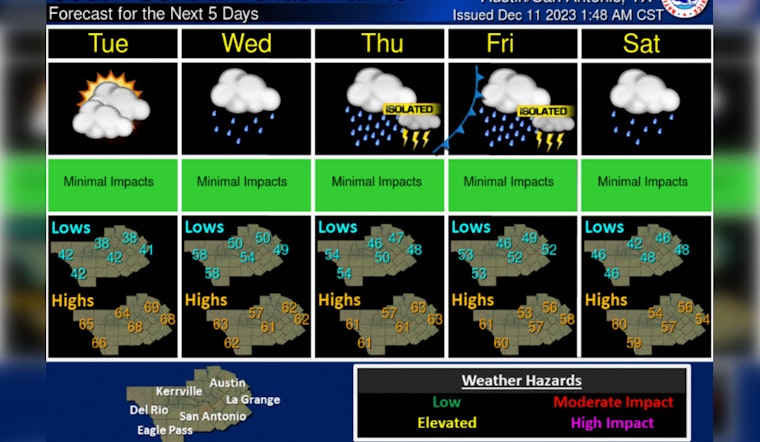
Despite the frosty start, Austin will see a sunny day with a high near 65 degrees, according to the National Weather Service. Tonight, the skies will remain mostly clear with lows around 40. The relatively mild weather takes a turn midweek as a slow-moving storm system advances toward the state, threatening to disrupt the tranquility with widespread rain.
KXAN's weather team, who's been monitoring the situation closely, reports that this unwelcome guest might be the harbinger of the "heaviest rain since October." The system is expected to make its presence felt starting midweek with a chance of showers that peak on Friday. These showers could bring relief to a region affected by drought and low lake levels, with potential rainfall totals ranging between 1"-3".
The transition from a cold snap to heavy rain is a welcome change for the parched land. With rising concern over dry conditions, the forecasted precipitation could be a boon for the local ecosystem. KXAN's coverage of the forecast has highlighted the positive impact the expected rainfall could have, replenishing soil moisture and helping to mitigate ongoing drought conditions.


