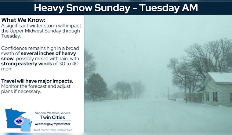
Minneapolis is bracing for a major winter storm expected to hit Sunday through early Tuesday, bringing with it heavy snowfall and winds gusting up to 35 mph, according to National Weather Service Twin Cities/Chanhassen MN. The storm watch follows a winter weather advisory in effect until 10 AM CDT this morning due to earlier snowfall.
Residents should prepare for "travel could be very difficult to impossible" as widespread blowing snow could "significantly reduce visibility." These conditions also threaten to impact both morning and evening commutes. The latest forecasts warn of 6 to 10 inches of heavy snow possible when the winter storm watch goes into effect from Sunday morning through Monday morning. Meanwhile, rain could mix with the snow at times, which would affect snowfall totals.
The weather service encourages spotters and snowfall observers to report any snowfall amounts, which helps keep communities informed and safe. As reported by the hazardous weather outlook, slippery spots on roads from the current snow are already posing challenges.
The weekend is set to see increasing clouds with a high near 33, leading into the stormy conditions starting Sunday. After the storm, temperatures may range with highs near 40 and lows around 17. The ongoing weather situation remains dynamic, and Minneapolis citizens are urged to monitor updates and be ready for the rapid onset of severe weather conditions. There's a call for residents to keep an eye on the changing skies and to adjust plans accordingly, particularly those planning travel.


