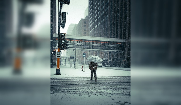
Minneapolis braces for a severe winter blast as the National Weather Service has issued a Winter Storm Watch effective from Sunday morning through Monday morning. The forecast warns of an incoming snowstorm set to pummel the Twin Cities metro along with other portions of central, east central, and south central Minnesota and parts of northwest and west central Wisconsin. Starting to lift up from the south, a heavy band of snow is expected to blanket the region with 6 to 12 inches of accumulation and wind gusts hitting as high as 35 mph, potentially crippling travel and reducing visibility due to high snowfall rates and patchy blowing snow. "Travel could be very difficult to impossible," the National Weather Service cautions.
Before the main event, light snow will begin Saturday night, but it is Sunday when the storm system hits in full force. As per the forecast, residents are set to wake up to snowy conditions with snowfall rates that could intensify to 2 inches per hour. The snow, touted to be heavy and wet, is expected to turn into rain in some areas, bringing uncertainty as to where the rain-snow line will establish itself. Although gusts could reaching 35 mph are forecasted to shake trees and power lines, creating visibility issues with the warm air that will cause snow to change over shortly to rain as the day progresses over much of southern Minnesota.
The conditions on Monday night are anticipated to worsen, with colder air pushing back into the area, changing precipitation back to snow. Hence, residents should prepare for additional inches of snow and even stronger winds gusting from 30 to 40 mph that may cause widespread blowing snow, especially in western Minnesota. According to the weather forecast, the system is expected to leave the area by Tuesday.
Residents are advised to monitor the latest forecasts and prepare for the inclement weather. The National Weather Service urges caution, emphasizing that this will indeed be a heavy, wet snow. The city's infrastructure may be tested, with the weight of the snow posing a risk to structures and roadways. Sunday night will see the rain possibly mixed with snow, bringing the threat of treacherous road conditions not just in the air but beneath the tires of every traveler brave enough to venture out.


