Residents of Minneapolis can expect a respite from the gloom as the days ahead promise clearer skies and a steady rise in temperatures, according to the latest weather reports.
The National Weather Service in Twin Cities details that, after a cloudy start, today will see gradual clearing, leading to sunny weather with highs creeping up from 40 degrees to an anticipated 67 degrees by Monday, yet as the mercury climbs the hazard of fire ratchets up with low afternoon relative humidities creating elevated fire weather conditions especially into the early part of next week.
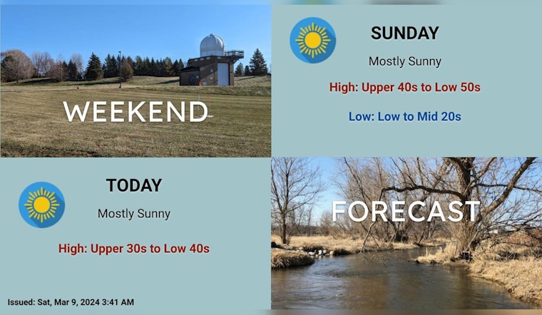
A quiet weekend is in store, with plenty of sun over the next few days. Highs near 40 today, near 50 tomorrow, and 60s possible early in the week. #mnwx #wiwx pic.twitter.com/Rzp3cQI4c1
— NWS Twin Cities (@NWSTwinCities) March 9, 2024
Forecast.weather.gov projects tonight will remain clear, with temperatures dipping to around 23 degrees, while a gentle transformation in wind direction from north-northwest to south indicates a warmer onset to Sunday, offering balmy conditions that are expected to continue into the following days.
The city's week ahead outlines a blend of partly sunny days interspersed with chances of rain starting Wednesday night, a pattern that lingers through the end of the week forecasts indicate a 20 to 30 percent chance of precipitation initiating after midnight and into the next days while temperatures hover around the mid-50s to low-60s ranges.
Despite the promise of milder weather and sporadic rains, the National Weather Service's Hazardous Weather Outlook cautions against potential fire risks, as the combination of dryer air and lower humidities present a critical situation for combustion, and although no immediate need for Skywarn spotter activation exists, vigilance remains vital throughout the dry spell.


