As the last total solar eclipse visible in the United States for the next two decades carved its path across Texas today, the celestial spectacle was marred for some by cloud cover and the looming threat of severe weather. High stakes atmospheric drama is unfolding over Southeast Texas as clouds gathered, dimming the anticipated dark of totality especially across the south, according to a detailed forecast by the National Weather Service.
While the North Texas region near Dallas-Fort Worth reportedly offered a somewhat clearer view, the Houston Chronicle notes that areas from Austin to San Antonio were less optimal for eclipse enthusiasts due to the significantly cloudy skies, as the forecast for Del Rio showed only moderate interference with 60 to 70% cloud cover allowing some residents to catch a glimpse of the eclipse phenomena before the weather's turn.
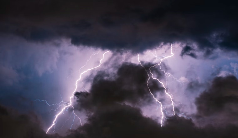
Following the eclipse, Texans braced for an outbreak of severe thunderstorms, large hail, and potential tornadoes. The Storm Prediction Center issued a grim outlook, projecting an "enhanced risk of severe thunderstorms in Southeast TX to West LA," with conditions ripe for "several tornadoes, a couple of which should be strong, significant large hail, and damaging winds."
Post-eclipse, nearly 20 million Texans found themselves at risk as severe thunderstorms brewed across the state, perils escalating with each storm cell that took shape, heavy rain impacting commutes and putting down fresh boundaries for subsequent storms to develop, bring with their fury tornado dangers and hail larger than 2 inches in diameter—the kind with a reputation for smashing windows and denting automobiles, the severity of the situation echoed by the Houston Chronicle warning of the potential damage from the looming severe weather.
As Tuesday approached, Houstonians were urged to keep a close eye on the volatile skies, with repeated waves of significant rainfall and thunderstorms anticipated. Breezy winds were expected to gust as high as 30 mph, as cited by the National Weather Service. The need for vigilance extended through midweek with forecast models generally indicating a persistent threat of severe weather along and north of the I-10 corridor, a forecast that seemingly knows no respite in the immediacy of nature's temper. Residents were encouraged to stay informed and prepare for what the skies might bring next.


