San Diegans are being told to brace for a bout of cooler weather and some showers, as temperatures take a dip and winds pick up across the region this weekend. The National Weather Service (NWS) in San Diego forecasts "a little cooler" weather today with a more significant cooling trend through the weekend due to a trough sweeping across the area, and light showers at times according to their latest update.
The marine layer was notably deep this morning, with cloud cover stretching across various valleys and lingering alongside the coast, meanwhile, upper level circulation was detected off the coast of Oregon and is anticipated to move south today by Saturday morning positioned west of San Francisco, this will pave the way for cooler temperatures and light precipitation in Southern California starting Saturday afternoon and into the evening, especially for counties such as San Bernardino and Orange, and followed by a second wave expected to hit on Sunday afternoon through evening, the NWS detailed in their Area Forecast Discussion.
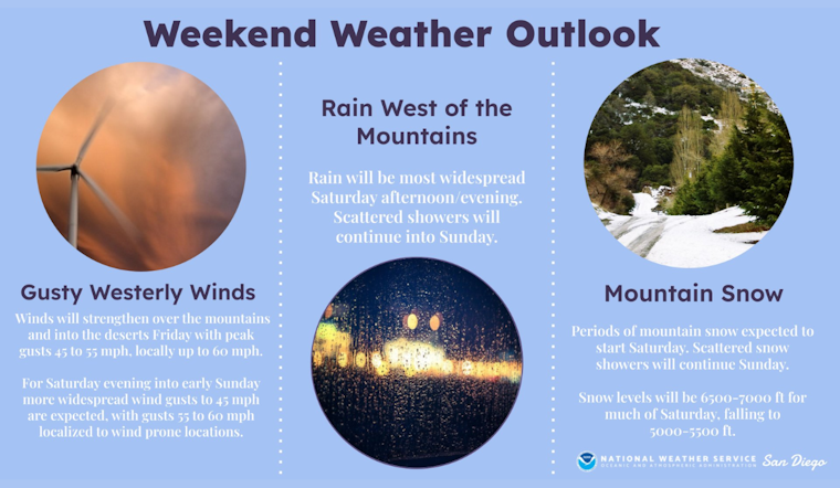
Weather predictions indicate that rain totals will be relatively modest over the weekend, with coastal and inland valleys seeing up to a quarter inch, and mountain and foothill regions possibly receiving up to a half-inch of rainfall. Snow levels are expected to drop to as low as 4,500 feet on Sunday, with 2-4 inches of snow accumulation forecast for the San Bernardino Mountains above 6,500 feet, the NWS stated. Additionally, the NWS's San Diego X account warned of strengthened winds over the mountains and deserts Friday and Saturday, with periods of rain and snow on the horizon.
Unsettled weather is on tap weekend. Winds will strengthen over the mountains and deserts Friday and Saturday. Periods of rain and mountain snow are expected as well. Precipitation will be most widespread Saturday afternoon and evening, with scattered showers Sunday. #CAwx pic.twitter.com/Jt6MOkSncv
— NWS San Diego (@NWSSanDiego) April 11, 2024
Residents can expect "another cool weekend with gusty winds at times," where Sunday is likely to be the chilliest day, featuring highs in the low 60s west of the mountains, and even colder temps in the mountains and high desert areas, the weather service outlined. Traffic might also be affected as gusty winds could lead to blowing dust and sand, especially in lower desert regions. Post-weekend, the region should see a return to dry weather with temperatures remaining slightly below average into the midweek. Mariners are also advised of potential showers at sea Saturday, while stronger west winds are on the radar for Sunday and Sunday night, though no severe marine conditions are expected, per the NWS's marine forecast.


