

























































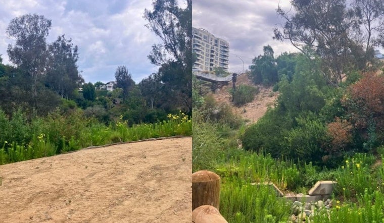
A $20 million effort to repair one of Bankers Hill's most erosion-prone natural corridors is nearing the finish line. The Maple Canyon Restoration Project, which includes slope repairs and a full streambed rebuild, is expected to be completed by the end of 2026, according to a City of San Diego post.
The project has already been recognized before its completion. The city's Engineering and Capital Projects Department received an award from the American Public Works Association San Diego & Imperial Counties Chapter, one of six projects the department was honored for, per the same city post. The restoration work is designed to reduce the chance of future erosion along the canyon, which sits in the heart of Bankers Hill and has long served as a critical drainage corridor for the surrounding neighborhood.
A Watershed Under Pressure
Maple Canyon's channel collects stormwater runoff from more than 100 acres of urban development, funneling it through 16 storm drain systems on its way toward San Diego Bay, according to Stormwater Solutions. Decades of uncontrolled urban runoff had severely degraded the narrow canyon channel, and the area sits within a Federal Emergency Management Agency Zone A floodplain, where the same publication reports that severe stormwater runoff historically caused bluff collapses, sinkholes, and heavy sediment buildup near major corridors like Pacific Highway. That sediment had previously jammed downstream storm drains and threatened nearby industrial facilities, the outlet notes.
Engineering work was split into two phases to tackle the problem from both ends. The first phase replaced the 16 failing storm drain systems with a single 48-inch pipeline, while the second phase stabilized 2,800 linear feet of stream channel using 28 grade-control structures alongside native vegetation, the report states. The design is meant to slow water flow velocity and retain sediment before runoff ever reaches downstream urban areas.
Disaster Funding Traces Back to 2017 Storms
The nearly $6 million federal grant backing the project came from the U.S. Economic Development Administration under its 2018 Disaster Supplemental program, established after severe winter storms and mudslides battered San Diego in early 2017, according to city documents. A 2017 presidential disaster declaration for San Diego County made municipal infrastructure projects eligible for federal flood mitigation funds. The federal agency estimated that funding the project would help protect surrounding commercial infrastructure and save approximately 2,000 local jobs, per the U.S. Economic Development Administration's own grant records, since guidelines required demonstrating economic resilience for businesses affected by localized flooding.
From Threatened Roadway to Protected Green Space
Maple Canyon's survival as open space wasn't guaranteed. Proposed urban development in the 1960s would have cut a major roadway straight through the canyon, but opposition organized by Citizens Coordinate successfully preserved the land, according to city records. Community activists and local architects fought the roadway project in 1964 and 1965, keeping the canyon intact as the green corridor it remains today.
Formal restoration planning didn't begin until decades later, in 2015, when the California State Coastal Conservancy granted funds to San Diego Canyonlands to develop low-impact development designs for a dozen urban canyons across the city. Environmental compliance for the current construction work has been governed by a Mitigated Negative Declaration adopted by the City of San Diego, requiring biological monitoring and native revegetation to protect habitats on the canyon floor, which supports eucalyptus woodland and non-native grassland sensitive to disturbance.
Canyon Rim Faces New Development Pressure
The restoration work is unfolding even as the neighborhood above it changes rapidly. In December 2024, the city completed the adjacent 0.75-acre Olive Street Park on Third Avenue, which features an overlook deck viewing Maple Canyon and houses the city's first AIDS memorial. But neighborhood expansion along the canyon rim has also drawn heightened scrutiny, including a high-rise that topped out nearby earlier this year, part of a broader push for housing density that has sparked neighborhood discussions about preserving the canyon's borders.


