Detroit faces a wet and blustery week, with the National Weather Service predicting a series of showers and thunderstorms sweeping through the city starting today. Weather forecasts indicate an 80% chance of precipitation, with the possibility of heavy rainfall during thunderstorms. "Showers and possibly a thunderstorm after 4 pm," are expected, with temperatures peaking near a comfortable 69 degrees despite the turbulent conditions, according to the National Weather Service.
Tonight, the likelihood of thunderstorms continues, mainly occurring before 7 pm, but the showers should give way to mostly cloudy skies and a dip in temperature to around 52 degrees. Winds from the west-southwest are anticipated to reach speeds of 11 to 14 mph, and gusts could hit as high as 23 mph.
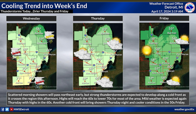
Respite comes briefly on Thursday with partly sunny weather and highs near 68 degrees, but showers are expected to return by nightfall. The temperature will hover around 52 degrees with a 90% chance of precipitation. Friday's forecast is not entirely bleak, with showers predicted to cease before 8 am and give way to a breezy day with a high of 60.
Looking ahead to the weekend, residents can expect a shift with cooler, clearer skies. Saturday should bring mostly sunny weather and a high of 53 degrees, while Sunday's forecast promises similar conditions with a few additional degrees of warmth. The start to the next week offers sunshine and a high of 63 on Monday, though there is a looming chance of showers by nightfall and into Tuesday.


