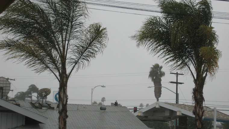
Bracing for a drastic dip in temperature, Southern California is gearing up for a rare weather twist that is set to include gusty winds, showers, and the potential for some snowfall. According to the National Weather Service San Diego, today's highs are expected to be substantially cooler—up to 20 degrees lower than Wednesday for the valleys, dipping into the mid 50s to around 60 degrees.
A low pressure system from the north is contributing to the changing weather patterns, plunging the region into a cooler state. The mountains and deserts are on alert for "areas of strong and gusty southwest to west winds" through late this afternoon into Friday morning, with "the strongest winds expected for late this afternoon into this evening," the NWS San Diego office warned. Gusts could reach a muscular 60 to 70 mph along and near the desert slopes. At the same time, rains are expected to soak the region, with up to an inch in some areas by Friday evening.
Snow isn't off the table either, as the forecast office indicates snowfall "of 1 inch or less is possible as low as 3000 feet with 2 to 4 inches from 4000 to 5000 feet." For those dwelling in the higher elevations, between 6000 to 7500 feet, up to a foot of snow could blanket the area. Adventurous residents and visitors should be cautious as the "snow level will fall to 3000 to 3500 feet by Friday morning," hinting at a crisp, if not frosty, kickoff to the weekend.
Meanwhile, the marine prospects are equally turbulent, with a build-up of wind swell leading to what could become "hazardous wind and sea conditions," particularly on Friday, as stated by the NWS San Diego’s Area Forecast Discussion. This gusty weather could also stir trouble out at sea—mariners beware: there's a Small Craft Advisory in effect from this morning through Saturday. Coastal areas should exercise caution as well, with surf potentially reaching up to 7-8 feet by late Friday, triggering dangerous swimming conditions and the threat of beach erosion.


