Texas is gearing up for a week of hazardous weather conditions. The National Weather Service (NWS) in Fort Worth has issued a stern advisory for North and Central Texas residents, warning of potentially severe weather brewing on the horizon. According to the Hazardous Weather Outlook, toasty temperatures today will push heat index values through the roof, hitting a sweltering 105 to 109 in some areas.
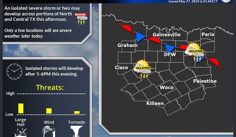
Memorial Day is set to be a scorcher with highs nearing 95 degrees and the heat index values climbing as high as 106, reports the National Weather Service. But not just the sun will be beating down hard; storm clouds are on the move, too. A cold front expected to roll in Monday evening brings a band of isolated yet potentially severe thunderstorms, with conditions ripe for large hail, damaging winds, and even a tornado, particularly near and west of the I-35 corridor.
As for the rest of the week, the skies won't be much kinder. Each day from Monday through Saturday, residents will be playing a guessing game with a 30 to 50 percent chance of showers and thunderstorms. The relentless spate of wet weather is poised to drench much of the region, with chances of heavy rainfall especially in the nighttime hours when residents typically seek solace in the quiet dark.
The impending conditions have Texans bracing for any possible impacts. While spotter activation is not currently expected, it's a signal that locals should remain vigilant and prepared. The NWS will be monitoring the situation closely, as should all residents in these storm-prone corridors. As if a week of rain wasn’t enough, the added mix of sizzling heat early on puts an exclamation point on the week's turbulent forecast.


