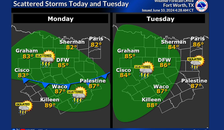
The National Weather Service of Fort Worth reported a series of weather conditions for the Dallas area, anticipating a mix of sunshine and potential thunderstorms for the coming week. As of June 10th, Dallas residents could expect a 40 percent likelihood of showers and thunderstorms post 10 am today, accompanying partly sunny skies and a high around 87 degrees. Light winds from the east northeast will blow at 5 to 10 mph. The chance of rainfall will decrease to 20 percent before the nighttime, giving way to a partly cloudy evening with lows around 71 degrees, according to the National Weather Service.
Looking ahead, Tuesday will bring a similar likelihood for showers and thunderstorms, specifically after 1 pm, whilst the weather is expected to largely remain partly sunny, reaching a high near 88 degrees. The rest of the week seems to gently escalate into greater warmth, with highs nearing 90 degrees on Wednesday, 94 on Thursday, and peaking to near 96 degrees on both Friday and Saturday. Those evenings are forecast to be mostly clear with lows in the low 70s. Sunday's outlook holds strong with sunny skies and a high near 97 degrees.
Beyond the general forecast, there exists a cautious eye towards potential hazardous weather. According to their released statement, the Hazardous Weather Outlook, scattered thunderstorms were possible mainly north of I-20 overnight. These carried the risks of lightning and could provoke localized heavy rainfall. While the threat for severe conditions appears to be low through the next few days, sporadic occurrences of small hail and gusty winds could manifest within the more intimidating storms. Rising concerns of flooding have been highlighted as areas with heavy rainfall may reaggravate existing conditions.
The weather narrative extends towards the upcoming weekend when sea breeze thunderstorms could travel far inland to affect areas such as Centerville and Palestine. For the moment, no spotter activation seems necessary. Still, locals should remain vigilant and prepare to adjust their plans accordingly, especially those living in areas previously or currently affected by flooding. This advisory underscores the unpredictable kinship between the calm of seasonal warmth and the sudden tumult of stormy weather.


