Starting July 15, the City of Fort Worth will implement new measures to more effectively define and regulate flood risk areas within its jurisdiction, a move aimed at amping up the city's defenses against stormwater runoff. This comes in light of a June 11 decision where the City Council voted to adopt changes to the Floodplain Provisions Ordinance, Stormhire Criteria Manual, and Grading Permit Ordinance, according to the City of Fort Worth.
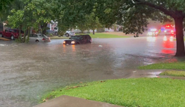
The adoption of these measures means that developments under an acre in size within City Flood Risk Areas (CFRAs) will require an engineer's certification to ensure that the elevation of living spaces sits at least two feet above the 100-year flood elevation. Moreover, these projects must demonstrate that they will not increase flood risks to nearby properties. This is critical because flooding can occur outside the areas typically mapped by the Federal Emergency Management Agency (FEMA), and often, as the city notes, more reports of flood damage come from outside these FEMA-designated areas.
Residents and businesses operating within the approximately 3.5 square miles of mapped CFRAs will benefit from heightened safety against flood risks, thanks to more rigorous stormwater development requirements. The city has also upgraded the Flood Risk Viewer with resources to help users identify their flood risks—both those mapped by FEMA and others identified by Fort Worth's mapping. This information, which can be accessed by entering an address into the Flood Risk Viewer, empowers residents to protect their homes and businesses proactively.
The expanded CFRA regulations will cover a range of development activities including the erection of fences, room additions, new construction, and modification of accessory structures, as well as commercial or mixed-use developments on plots of less than an acre. Development within FEMA floodplains, or any activity that disturbs land of one acre or more, will continue to be subject to a detailed review process. The city has created FAQs on non-FEMA flood risk mapping, available on the City's webpage, and invites queries at 817-392-1234 or via email for further information.


