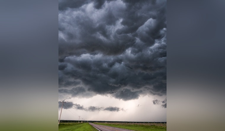
As the swelter of mid-July takes hold, the National Weather Service in Las Vegas has issued a forecast that signals the onset of monsoonal patterns, with thunderstorms likely to roll across the region today and tomorrow. According to the forecast discussion, residents in Nevada, Arizona, and California can expect frequent lightning, gusty winds, and heavy rainfall which could bring about gusts reaching at least 40 mph. The storms also come with a threat of blowing dust, which may reduce visibility and create precarious travel conditions.
While centered over the Four Corners, the 500 mb high is stirring up trouble with its southeasterly winds, drawing a rich vein of moisture into the area. With atmospheric conditions ripe, a "Marginal (5 percent) risk for excessive rainfall" has been placed over eastern Mohave County for potential flash flooding. The National Weather Service also warns of increased fire weather risks, especially in the eastern Sierra and Owens Valley where a Red Flag Warning has been hoisted, and "dry thunderstorms and cured fuels on the ground" adding to the combustible mix.
In terms of the mercury reading, the Las Vegas area is expected to receive a modest reprieve from the scorching heat experienced earlier this week. "HeatRisk" will dip into a Moderate (Level 2), yet afternoon highs are forecast to sit stubbornly above averag— a small consolation for those weary of the relentless sun.
Looking beyond the weekend, the high-pressure ridge should persist, albeit with conditions growing drier as the new week marches forth. Those eager for respite may take solace in knowing that while temperatures will remain toasty, they're slated to cool from the recent highs recorded past. "Drier conditions can be expected each day through the week," said the weather service, signaling a return to the typical sizzle sans the stormy interlude.
Aviators treading the skies around Harry Reid International should brace for potential disruption, with forecasters predicting a 40% to 50% chance of storm activity directly impacting the field between 23Z to 03Z. Meanwhile, the rest of southern Nevada, northwest Arizona, and southeast California can anticipate more scattered convective action this afternoon and evening. But fear not, as these stormy skirmishes should settle down after sundown, leaving quieter skies in their wake.
Lastly, the "SPOTTER INFORMATION STATEMENT" invites local weather spotters to report any significant weather or impacts they come across, which is standard practice during such unpredictable events. It's all hands on deck as the region prepares to ride out the tumultuous tides of monsoon season.


