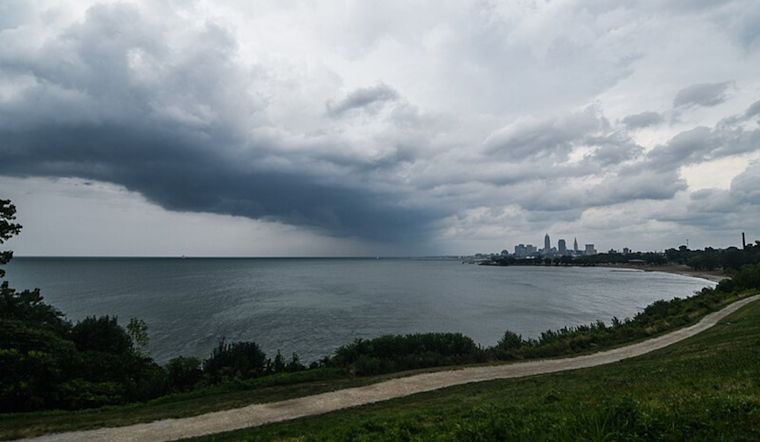
Residents in Cleveland and the surrounding areas were given a heads up early this morning about potential severe weather set to stir up throughout the day. The National Weather Service in Cleveland cautioned that a stationary boundary just south of Lake Erie is forecasted to govern severe weather potential as a low-pressure system from the Midwest travels east along this front in the afternoon and evening.
This atmospheric setup could translate to quite the eventful day for Ohio residents – with the severe weather threat escalating between 2 PM and 8 PM, or 18-00Z in meteorological lingo. The exact timing is crucial since it will determine when the region gets placed under the upper-level jet's right entrance region, a prime spot for storm development. "The best chance of these strong to severe storms will be between 18-00Z this afternoon," noted the National Weather Service. Despite minor temperature tweaks, the rest of their forecast remained unchanged, with particular attention to storm threats: strong wind gusts, an outside chance for hail, and even tornado possibilities highlight today's hazards.
The anticipation of this weather pattern has prompted the Storm Prediction Center to issue a Day 1 Slight Risk for the area. It's a warning not taken lightly, as supercell formation and tornadic activity could rear its head near the boundary – a scenario painted by an ominous 'humped' hodograph mentioned by the NWS. Besides the severe weather specter, torrential rainfall leading to flash flooding, especially in urban locales and regions with poor drainage, is a major concern.
As the night ushers in, the weather system and the boundary will begin moving southeast out of the region, allowing for high pressure to introduce more agreeable conditions. But until then, residents are advised to be vigilant. "Definitely stay tuned for forecast updates throughout the day and stay weather aware today," the NWS cautioned – a reminder that while the skies might be overcast, residents should keep their eyes peeled on the changing weather landscape.
Looking ahead, boaters will also need to navigate cautiously as a Small Craft Advisory takes effect from noon today across the lake, with Beach Hazards Statements hoisted for stretches of shoreline. These advisories speak to the increased northeast winds, a byproduct of the day's low-pressure stirrings. "Have gone ahead and hoisted a Small Craft Advisory and Beach Hazards Statement for the entire lake starting this afternoon," the NWS reported, signaling the intertwined nature of onshore and offshore weather impacts.


.jpg)