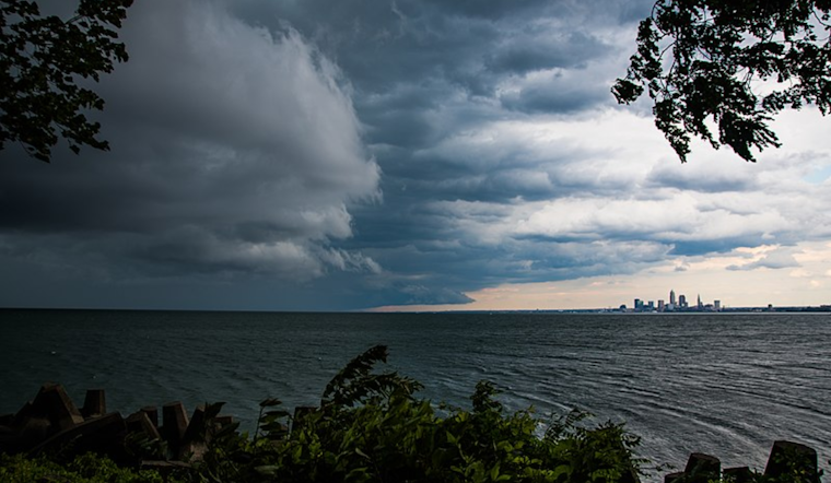
The National Weather Service in Cleveland has released a forecast that calls for fluctuating weather patterns over the Great Lakes region throughout the weekend. According to the estimates, low pressure drifting east is set to bring a cold front across the area today and tonight, with a subsequent exit making way for high pressure through midweek. This pattern will usher in isolated showers, thunderstorms, and cooler temperatures.
The area's near-term weather outlook indicates that while this morning may see only a few isolated showers across most of the region, the afternoon and evening hours could be different as the cold front progresses eastward. The eastern part of the forecast area, mainly east of Interstate 71, might experience the brunt of the action, with forecast probabilities of precipitation in the 80-90% range. "Although most model guidance suggest slightly better forcing with a pre-frontal trough or subtle shortwave aloft for the eastern part of the forecast area" noted the National Weather Service.
Despite the moderate instability and potential for thunderstorm development today, the severe weather threat remains marginal. Organized severe convection is deemed unlikely due to deep layer shear being "generally expected to be in the 20-30 knot range", stated by the National Weather Service report, which insufficiently supports storm organization. Nonetheless, stronger gusty winds emerge as the primary hazards during these thunderstorms, while freezing levels too high for severe hail and low-level shear too low for tornadoes downplay other severe threats.
The unstable atmosphere will linger a bit longer in the upcoming week, with ongoing chances for scattered showers and storms. The start of the new week might not bring immediate relief, but clearer skies are on the horizon as the weather stabilizes by Tuesday. However, conditions on Lake Erie during this time are forecast to be less calm, with "waves as large as 3 to 6 feet, especially east of The Islands where fetch will be greater," the National Weather Service explained. Mariners should anticipate the need for potential Small Craft Advisories and Beach Hazards Statements, as waterspouts could accompany the cold front.
As the region transitions into midweek, peaceful weather looks set to take hold. A ridge building from the northern Great Plains is projected to promote fair conditions. Temperatures will undergo a gradual incline, with highs expected to reach the lower to mid-70s on Wednesday and potentially into the mid-80s by Friday.


