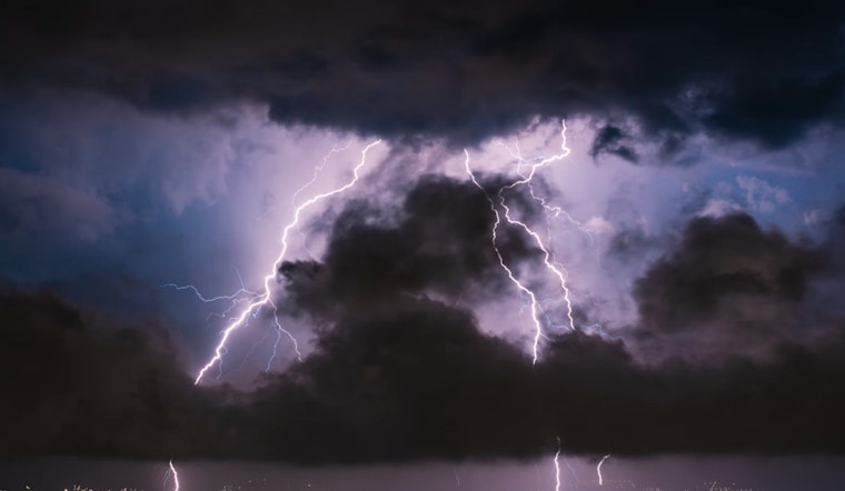
The National Weather Service in Las Vegas has issued a forecast highlighting that widespread showers and thunderstorms are expected to rapidly move through the Mojave Desert today and into the night. According to their recent Area Forecast Discussion, this activity is being driven by a low-pressure system swinging in from near the Los Angeles area, across the desert, and into northern Arizona by tomorrow morning. While the weather is set to disrupt several areas with the possibility of brief heavy rainfall and gusty winds, conditions should dry out and warm up as the weekend progress.
The showers and thunderstorms are anticipated to mostly affect the San Bernardino County Deserts, including Barstow-Daggett, Baker, and the Morongo Basin through mid-afternoon. Notably, "CAPE values across these areas will climb into the 500-750 j/kg range resulting in isolated stronger storm cores, and with 500mb temps of -15 to -16C, a few instances of small hail are possible as well," the National Weather Service stated. Southern Nevada and northwest Arizona are expected to start experiencing the most significant effects of this system from sunset through midnight. Las Vegas is forecast to potentially observe this weather during these hours, as the low-pressure system continues to move eastward.
Aviation forecasts for Harry Reid International Airport indicate that light winds will become southeasterly by mid-day and continue through the early evening, with wind speeds around 7 to 11 knots, and the possibility of gusts around 15 knots after 21Z. The risk of scattered showers and isolated thunderstorms will rise by evening, potentially affecting the airport operations after sunset. "Storm chances should end by 08Z, but a few showers may linger through the night," according to the NWS forecast discussion.
Spotter information provided by the National Weather Service encourages local spotters to report significant weather events. As the system moves through, causing potential disruptions and weather phenomena of note, such community reporting can provide crucial, on-the-ground data. By tomorrow, drier and more settled conditions are predicted to return, bringing temperatures slightly below normal before they bounce back closer to seasonal averages on Sunday. For residents and travelers alike, the forecast is a reminder to be prepared for changeable weather conditions as the week draws to a close.


