The National Weather Service in Cleveland has reported a weak cold front moving eastward today, bringing scattered rain showers mainly to the south of a line from Mansfield to Cleveland to Erie. According to the NWS forecast, the high pressure expected to follow should lead to clearer skies this afternoon. However, as we edge into the weekend, the tropical remnants of Helene are slated to enter the Ohio Valley by Friday night and linger, although rapidly weakening.
Friday brings heightened chances for precipitation, particularly south of areas including Findlay, Mansfield, and Akron, with "60-70% PoPs." As Helene's remnants disintegrate upon reaching the Ohio Valley, the flood risk is minimal. However, some central parts of Ohio might benefit from a quarter to half an inch of rain. In short, Ohioans should keep their rain gear handy but won't need to brace for severe weather.
As the weekend unwinds, the weather that once was Helene will sprinkle the state with showers, possibly accompanied by isolated thunderstorms. Don't cancel your outdoor plans yet. The showers are expected to be more miss than hit and light, per NWS Cleveland’s forecast discussion. Saturday and Sunday's peaks in diurnal heating raise chances of rainfall, particularly in the southwestern part of the forecast area, closer to the surface low.
The upcoming work week could dry out as the upper low drifts away, with only a lingering upper trough stirring potential shower activity until Tuesday morning. NWS Cleveland tells us to anticipate "slight chance to chance PoPs" for now. The parade of systems continues with another upper trough following closely behind, potentially bringing precipitation around Tuesday into Wednesday. In true Midwestern fashion, temperatures will hover near or slightly above average, then possibly dip below the norm come Wednesday due to cold air advection behind a cold front.
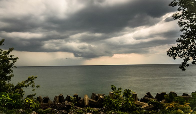
Over on Lake Erie, mariners should note that northeasterly winds will strengthen, peaking Friday afternoon and evening with gusts reaching up to 35 knots. Sailors, be advised that Small Craft Advisories will be in effect come Friday and may persist through the weekend in certain areas. More tranquil east/southeast winds are expected to take over by Monday, according to the latest marine weather update from NWS Cleveland.


.jpg)