The National Weather Service in Sacramento has issued an update about the weather for Northern California starting this Sunday. The NWS forecast discussion from early Friday morning paints a picture of elevated fire weather conditions due to dry and windy situations, followed by an active pattern that could bring showers, thunderstorms, and a significant dip in temperature.
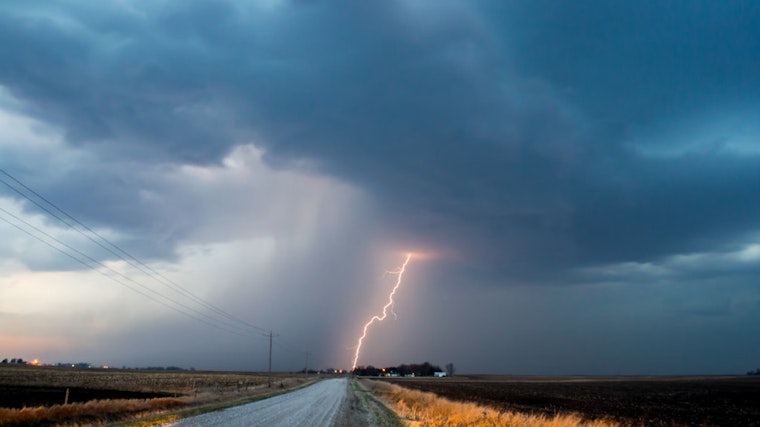
Before the week's end, the Sacramento region should experience seasonable weather with highs in the upper 80s to mid-90s in the Valley. However, an upper-level low is expected to abruptly force its way south from the Pacific Northwest by Sunday. This shift is to "bring along scattered showers and thunderstorms," according to the National Weather Service. They’re watching closely for potential debris flow concerns in the Park Fire Burn Scar area.
The forecast indicated a 15-25% chance of thunderstorm development mainly over the northern Sacramento Valley and surrounding regions. Meanwhile, precipitation projections remain modest with under a tenth of an inch anticipated south of Interstate 80, expanding to a possible half-inch to one inch in localized northern areas. This influx of wet weather is a stark swivel from the dry and warm conditions experienced earlier in the week.
As if scripted by the changing seasons themselves, gusty winds are expected to accompany the shift, with 20 to 35 mph gusts, "especially in the vicinity of the Delta and over the Sierra Crest," noted the National Weather Service discussion. The plunge will continue into early next week, with valley highs hovering at or below 80 degrees on Sunday, before slipping into low 70s on Monday. The cool-off precedes another transition, where temperatures gradually begin to warm back up as the week progresses.
VFR conditions are reported to prevail in Northern California for the aviation sector. "Surface winds generally at or below 12 kts," observes the NWS, ensuring minimal disruption for the next 24 hours. As Californians keep an eye on the skies, the true pivot will likely be how swiftly they can adapt to the potentially disruptive pattern poised to set in by Sunday.


