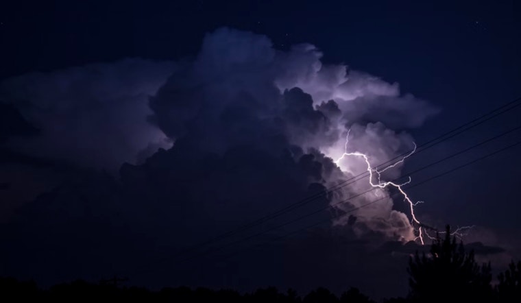
The National Weather Service in St. Louis has issued a Hazardous Weather Outlook for today, signaling a slight chance of thunderstorms this afternoon across various parts of eastern and central Missouri, as well as west central and southwest Illinois. As residents go about their Monday routines, they should be aware of the potential for these weather events to disrupt outdoor activities, according to the National Weather Service.
Sky-watchers in counties such as Greene, Macoupin, and Montgomery in Illinois, and Knox and Lewis in Missouri, should note the forecasted weather conditions. While the likelihood of thunderstorms is low, unpredictable weather patterns can always surprise. The temperature hovers around a comfortable 70°F with a significant humidity level at 79%, which could contribute to the development of late afternoon storms, as reported by the National Weather Service.
The outlook for the rest of the week appears more promising, with the National Weather Service predicting no hazardous weather from Tuesday through Sunday. For those making plans for the upcoming days, this might come as reassuring news.
According to the latest update provided by the National Weather Service, "There is a low chance for thunderstorms this afternoon." For today, and night, this is the extent of potential weather-related disruptions. As of now, spotters, who are typically called upon for ground-level weather reporting during significant meteorological events, aren't expected to be activated.
Staying informed about such advisories is essential for public safety and management of daily activities. Updates from the National Weather Service and local meteorologists will continue to provide the latest weather information for these areas, ensuring that the public remains aware of any changes in conditions.


