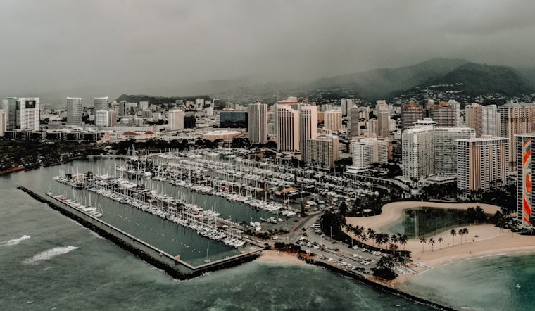
Honolulu residents and visitors should be ready for a damp couple of days as moderate to breezy trade winds continue to affect the islands, bringing with them an uptick in wet weather, especially in windward areas. According to the National Weather Service, a slug of deep moisture is currently moving from east to west across the islands, which is expected to increase showers through tonight.
While these conditions are usual for the locale, the wet weather is anticipated to persist beyond the typical morning passing showers, mainly affecting windward slopes and coasts. In line with the National Weather Service's latest bulletin, "numerous to widespread shower activity over windward areas from Oahu eastward, with scattered showers moving into windward Kauai" have been reported. Despite this, general trade wind conditions that usually bring windward and mauka showers should resume by Tuesday and continue into the weekend.
As far as aviation is concerned, moderate to breezy trades will stick around for a few days, leading to the possibility of turbulence over and downwind of the island terrain. In windward regions, low clouds and showers might bring about mountain obscuration, this is particularly pertinent for aviators who may encounter MVFR or isolated IFR conditions in the heavier showers.
Sea conditions will be rough, with a Small Craft Advisory in effect for Maui County and the Big Island through Tuesday night. High pressure driving the winds is expected to weaken later in the week, which might slightly calm the winds. Until then, expect choppy surf along east-facing shores.
Coastal areas are also facing flooding issues due to high tides and elevated water levels. A Coastal Flood Statement warns of possible localized flooding each afternoon through Tuesday. Weather across the Hawaiian Islands will shift from the current wet conditions to the usual trade wind pattern as the week progresses.


