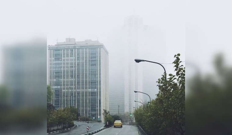
The National Weather Service in New Orleans has issued a Dense Fog Advisory this morning for parts of Southeast Louisiana and Southern Mississippi, with the visibility dropping to one-quarter mile or less in dense fog. Motorists are advised to exercise caution, as the reduced visibility is expected to create hazardous driving conditions until 9 AM CDT. The advisory encompasses wide areas including New Orleans, Baton Rouge, and extends to various other localities such as St. Helena and Washington Parishes, according to the NWS.
The foggy conditions this morning are a prelude to the day's weather which will clear up as it progresses; the National Weather Service predicts that skies in New Orleans will shift from partly sunny to sunny, with a high of around 83. As the day goes on, the sun will break through the fog. The weather tonight will turn clear with a low of around 69 and an east wind of around 5 mph.
Heading into the week, Tuesday will bring sunny skies and a high near 82, with an east wind of 5 to 15 mph, offering a welcome consistency in weather patterns. Tuesday night's conditions are looking mostly clear with a low near 72 and easterly winds around 10 mph, and there might be gusts soaring as high as 20 mph; while Wednesday's forecast also promises mostly sunny skies and a high around 83, accompanied by a southeast wind at 10 to 15 mph, according to the detailed forecast by the National Weather Service.
For those looking ahead, the latter part of the week hints at a shift with a 40 percent chance of showers and thunderstorms after 1 pm on Thursday, the skies will remain partly sunny with a high near 82, and gentle southeastern winds at 5 to 10 mph, and as we tilt into the evening, there persists a 20 percent chance of showers and thunderstorms but these will likely call it a day before the clock strikes 1 am, leaving in their wake a mostly cloudy night with a low around 70 and an east wind meandering at around 5 mph. Heading into the weekend, residents can expect the sunny disposition of the weather to bounce back, with temperatures consistently floating in the low 80s and a light breeze from the east to keep the air from stagnating.


