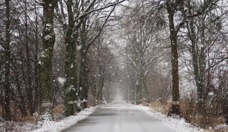
The National Weather Service in Sacramento has reported that Northern California is expected to experience its first significant precipitation of the Water Year, continuing through today until Saturday. According to the forecast, the rain and snowfall is part of two consecutive waves, with a brief respite anticipated this afternoon and evening before a wetter second wave arrives tomorrow evening. A Winter Weather Advisory is also in effect for elevations above 6000 feet in the northern Sierra until 5 PM today.
Currently, the Sacramento Valley and Foothills are witnessing light rainfall, and the Sierra has light snow showers. As of this morning, the rainfall totals range from minimal traces to approximately 0.15 inches, with the higher totals in the northern Sacramento Valley, specifically at Redding AP. Following these precipitation waves, the National Weather Service predicts breezy northerly winds to develop on Sunday and continue into Monday, with potential gusts of up to 30mph, especially along the I-5 corridor and the Delta. However, the recent showers are expected to lower fire weather risks for the region.
Tomorrow's incoming moisture may bring isolated thunderstorms with it, raising concerns about "dangerous lightning, heavy rainfall, gusty erratic winds," as per the NWS. The second wave's trajectory still holds some uncertainty, which will influence overall precipitation. Snowfall accumulations are projected around 6-12 inches in the Sierra through Saturday, adding to what has already fallen, while rainfall across the valley is expected to range between an additional 0.50 inches to 2.00 inches.
Regarding aviation, the National Weather Service advises that in the Central Valley, MVFR/IFR conditions in showers are possible until 19z today; thereafter, mainly VFR conditions should prevail. In the foothills and mountains, areas of MVFR/IFR with local LIFR obstructing terrain could persist until 01z tomorrow. Snow levels will begin at 4500-5500 ft but are set to rise later today. Ongoing advisory statuses are likely to be updated with the progression of these weather systems, and the public is encouraged to stay tuned to official updates.
Looking ahead to next week, "EPAC upper ridging builds into NorCal," signaling a shift to dry weather with gusty northern to easterly winds from Monday into early Thursday. As conditions evolve post-precipitation, the National Weather Service cautions that there may be elevated fire weather concerns later into the week. Temperature-wise, the region can expect a gradual warming, with temperatures returning to near normal by next Thursday.


