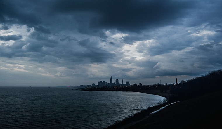
This afternoon, a strong cold front barreled across Northeast Ohio and Northwest Pennsylvania, prompting the National Weather Service in Cleveland to sound the alarm for potential severe weather conditions. The alert, issued earlier today, points towards the likelihood of thunderstorm development and severe weather in the regions during the late afternoon and into the early evening hours. The forecast discussion on the NWS Cleveland website also highlighted an elevated fire danger in Northwest Ohio following the front later this afternoon due to gusty synoptic winds.
Temperatures were anticipated to climb into the low to mid-80s in much of Ohio, with wind gusts picking up just after sunrise this morning. The NWS warns of gusts hitting 25-35 MPH, which could quickly escalate later in the day. One concern is the surge of gustier winds behind the front early this evening, possibly reaching 40 MPH along the Ohio lakeshore between Vermilion and Ashtabula, driven by strong cold air advection.
The forecast discussion also sheds light on a possible severe weather scenario. "Most models continue to blow the cap quickly around or just after 18z/2 PM, and given strong frontal forcing and assistance from the left-exit quadrant of a 80-100kt upper jet streak we should see convection quickly initiate and intensify once the cap erodes," the discussion reads. Thunderstorms that may develop could pose risks, including large hail and damaging wind gusts, thus a "Slight Risk" (level 2/5) advisory was set in place by the NWS. The Slight Risk advisory extends from roughly east of an Ashtabula to Canton line, surrounded by a Marginal Risk as far west as an Eastlake to Mount Vernon line. The main threats are winds and hail, with a lower potential for tornadoes.
In the wake of the front's passage, a cooler, somewhat moist airmass is expected to dominate late tonight into Monday, leading to lake effect clouds and light showers, mainly east of Lake Erie. These weather dynamics may impact aviation, with possible low VFR to MVFR ceilings developing southeast of the lake into Monday morning, affecting regional flights. A dry slot is predicted briefly to come in behind the front this evening, with scenarios of non-VFR ceilings, probable in lake effect clouds, and light showers across northeast OH and northwest PA on Monday, according to the NWS forecast.
On the waters, Lake Erie saw a Small Craft Advisory, with southerly winds ahead of the front climbing to 20-25 knots and westerly to northwesterly winds crescendoing to 20-30 knots post-frontal. The advisory is expected to last through the evening west of the Lake Erie Islands and into Monday afternoon to the east, where waves will subside more slowly. Mariners are advised to be cautious as choppy conditions persist into the early week, although they're projected to subside by midweek with the establishment of high-pressure systems.


.jpg)