The National Weather Service in New Orleans has issued a Coastal Flood Advisory that will remain in effect until 6 AM CST Tuesday. Residents along the coastal portions of southeastern Louisiana and Mississippi are expecting minor coastal flooding, with waters possibly rising 1 to 2 feet above the normally dry ground, especially along southeast-facing shores.
According to the forecast, the current conditions in New Orleans are fair, with a humidity of 85%, and winds coming from the southeast at 9 mph. The barometric pressure was holding steady at 30.01 in (1015.4 mb). The NWS has disclosed that these conditions contribute to the coastal flooding situation, as the southeastern winds may push sea levels higher along the coast. Besides the flood advisory, the weather is expected to be mostly sunny with highs nearing the mid-80s for most of the week.
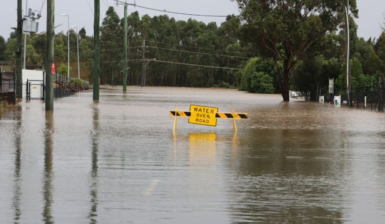
For those planning outdoor activities or travel in the affected areas, the NWS advises extra caution. They warn "If travel is required, allow extra time as some roads may be closed. Do not drive around barricades or through water of unknown depth." They also encourage taking necessary actions to protect property in flood-prone areas. The rest of the week's detailed forecast sees the possibility of slight chances of showers towards the weekend, with showers more likely before midnight on Friday.
Local residents and authorities are likely monitoring the conditions closely. The impact of the advisory includes potential flooding of lots, parks, and roads with only isolated road closures expected. Further updates and up-to-date information can be accessed through the National Weather Service's official website.


