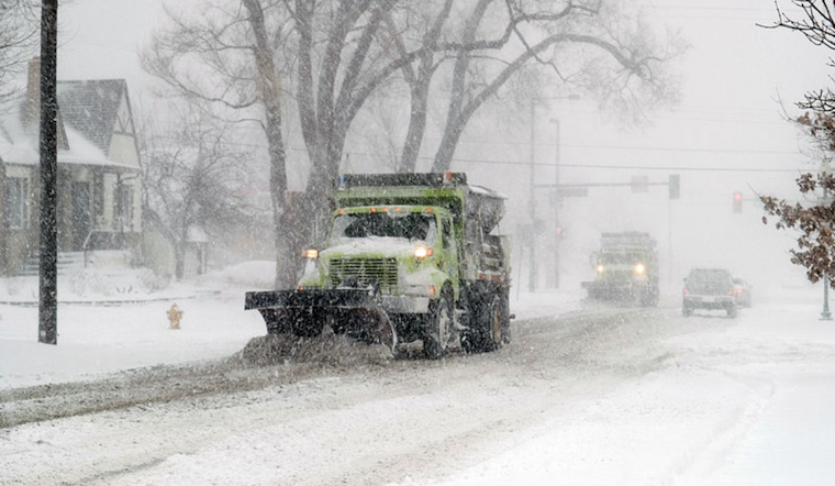
Denver residents, brace yourselves for a wintry mix. According to the National Weather Service, a potent weather system is ushering in heavy snowfall in the mountains, likely to cause significant travel disruptions until Wednesday. The city itself might catch a breather today with a mostly sunny sky and a comfortable high of 53 degrees before the weather takes a turn for the worse.
Tonight's forecast doesn't look as friendly, there's an 80% chance of rain transitioning into snow, with potential accumulation of less than half an inch, however. Wednesday is expected to bear the brunt of this system with a 90% chance of snow and possible new accumulation of 1 to 2 inches. The mountains, on the other hand, should prepare for "Heavy mountain snowfall," with road conditions likely to deteriorate through Wednesday.
The midweek mayhem eases off by Thanksgiving Day, which looks promisingly sunny with a high near 41 degrees. The night, however, will see temperatures dipping to around 16. Drivers should be cautious, particularly Wednesday night into Thursday morning, when there may be, icy conditions from wet roads freezing as the mercury falls.
The outlook extending into the weekend, according to the NWS update, promises a reprieve from the wintry blast. Denverites can anticipate dry conditions, with temperatures gradually climbing back up. Otherwise, dry weather is expected through the weekend with moderating temperatures, the NWS bulletin states. Snowfall reports from spotters during this period would be very much appreciated by the local weather service office.


