Residents and travelers in the Las Vegas area should brace themselves for a cocktail of weather changes, as the National Weather Service in Las Vegas anticipates a cold front to usher in gusty north winds and lower-than-average temperatures. Today might offer a brief warmth and calm before the front arrives this evening, a reprieve from the recent wind activities, according to the National Weather Service's forecast discussion.
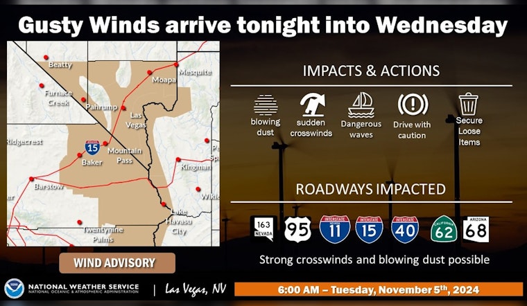
This evening, the incoming cold front is expected to generate strong north winds across southern Nevada, far southeastern California, and the Lower Colorado River Valley zones. Wind Advisory warnings have been issued due to the high probability of 40+ mph wind gusts. With winds picking up, the forecast reports asynchronous hazards, including blowing dust, and perilous boating conditions are also expected, as per a statement released by the National Weather Service.
Tomorrow is projected to be the chilliest day the region has seen since early April, bringing with it temperatures that may not climb beyond 59 degrees in Las Vegas. North winds will carry on through the day, especially where Wind Advisories are still valid into the evening. Following sunset, clear skies are likely to allow temperatures to plummet, prompting the National Weather Service to issue Freeze Watches for certain areas vulnerable to freezing conditions.
Heading into the weekend, a gradual moderation is expected. The low-pressure system should begin moving east by Friday, leading to decreasing winds. Weather over the weekend looks stable, with models predicting dry conditions and lighter winds on both Saturday and Sunday. However, Monday's outlook remains uncertain, with weather models divided on the behavior of an approaching low from the Pacific Northwest. While models agree on the low's approach, there’s a nearly even split on whether it will amplify and slow down or stay weaker and move faster.
Aviation sectors within the Las Vegas Valley and areas in southern Nevada, northwest Arizona, and southeast California should prepare for the imminent shift in wind direction and intensity accompanying the cold front. The North push, expected later today, could result in gusts up to 30 knots at Harry Reid Airport, increasing post-sunset. This pattern is expected to extend into tomorrow morning and change to a northeasterly wind by the afternoon. Officials urge spotters to report significant weather impacts as per standard procedures in readiness for the heavy gusts forecasted.


