Sacramentans breathed a temporary sigh of relief as the National Weather Service (NWS) Sacramento reported a weakening of winds across the Valley and Delta this morning, offering a reprieve from the recent gusty conditions. According to the NWS, the weakening winds are attributed to an eastward-moving low over the Great Basin, resulting in a subdued north-to-south pressure gradient. As a result, the NWS has opted to cancel the previously issued Wind Advisory ahead of schedule. Still, hold on to your hats—gusts ranging from 15 to 30 mph are expected to continue until the afternoon.
However, the winds are expected to pick up once again tomorrow. The latest forecast indicates stronger winds aloft over Northern California compared to earlier model runs, as per the NWS's area forecast discussion. Forecast gusts are set to reach 15 to 35 mph, with the fiercest winds anticipated along the I-5 corridor in the Sacramento Valley and Delta. Wednesday is shaping up to be of particular concern, as an upper-level low is expected to descend into the Great Basin by Tuesday night, resulting in stronger north winds and raising red flags over fire weather conditions due to lowered humidity levels and potential fuel dryness.
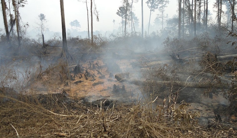
The NWS points out that Wednesday's conditions merit special attention due to the likelihood of elevated fire weather concerns. These conditions will result in increased fire weather risks, especially since overnight relative humidity levels will struggle to recover from tomorrow's winds. The determining factor for large fire spread will be the dryness of available fuels, despite the presence of meteorological conditions that support elevated fire weather situations.
Looking beyond midweek, the forecast indicates a persistence of dry and blustery weather patterns. From Friday through Monday, gusty north to east winds are expected across the wind-prone areas of the Valley and Sierra, as mentioned in the NWS's extended discussion. While there is uncertainty about next weekend's conditions due to the potential influence of a low-pressure system in the Gulf of Alaska, it seems that the current ridge over Northern California might shift eastward. Despite attempts by the National Blend of Models (NBM) to suggest possible rain chances during the weekend, very little measurable precipitation is expected, with temperatures forecasted to be close to or slightly below the seasonal norm.
Aviation wise, VFR conditions are expected to prevail with gusts up to 25 kts winding from the north through the Delta and 25 to 35 kts from the east along the Sierra likely persisting until 15z, after which it should taper off. Breezier north winds up to 12 kts are forecasted elsewhere through 18z, with winds gradually decreasing as the day progresses.


.jpg)