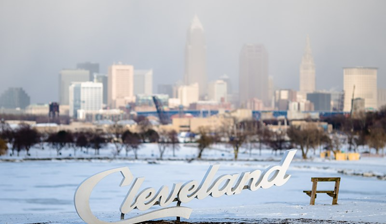
As Cleveland braces for a harsh winter spell, the National Weather Service (NWS) has provided a detailed forecast report on the lake-effect snow event battering parts of Ohio and Pennsylvania. In an update this morning, the NWS confirmed that a surface trough is advancing over northern Lake Erie, prompting the expectation that snow bands will intensify as they move southward. With the weather patterns firmly set, the NWS is certain that today's conditions will be characterized by heavy lake-effect snow and gusty winds, particularly in the snowbelt areas.
According to the NWS Area Forecast Discussion, a trough of low pressure is expected to maintain its grip across the Great Lakes for most of today, with a ridge of high pressure aiming to build over the Ohio Valley tonight into Friday. The forecast, updated at 7:15 AM EST, also points to a possible consolidation of lake-effect bands into a more potent west-east formation, containing snowfall rates as heavy as 1-2 inches per hour in some areas. Already grappling with the arctic-like blast, Cleveland will have to hunker down for additional snow, which will drift back into the region tonight as the surface ridge builds in.
Focused on the near term through Friday, the weather update projects an arctic air burst that will bring significant lake-effect snow, especially to the primary snowbelt. Snowfall 6-12 inches could strike Erie County and sample smaller accumulations elsewhere. The NWS statement mentioned that "winds will also remain gusty" and cited the potential for "blowing snow in northern portions of the primary snowbelt east of Cleveland and in NW PA."
The NWS forecast discusses the brief respite of fair weather expected to stretch from Friday night through Saturday. However, moving into the weekend, the region is warned to prepare for the proverbial "rinse and repeat" as another low-pressure system approaches, bringing with it periods of heavy rainfall. The ensuing wet conditions, coupled with the melting snow, might have implications for the broader hydrological status in the area, with concerns for potential flooding in some zones.
Looking at the marine implications, the marine forecast from the National Weather Service asserts that a Gale Warning is in effect for nearshore and open U.S. waters from The Islands to Buffalo until 4 PM EST this afternoon. Strong westerly winds howl up to 35 knots, churning up waves as towering as 14 feet, though these are expected to diminish somewhat as the day wears on. As the conditions across the lake become hazardous, mariners must be highly alert for the dynamic and severe waterscape.
The overarching theme of these updates is preparedness and vigilance as the weather continues to play out its wintry symphony across the Great Lakes region. Stay informed and stay safe, Cleveland.


.jpg)