According to the latest forecasts from the National Weather Service, clevelanders can expect a mixed bag of weather conditions in the coming days. While today marks somewhat clearer skies following snow flurries in the region, a new system is on the horizon, threatening to stir up a mix of rain and snow over the weekend. The NWS Cleveland's Area Forecast Discussion details the approaching "clipper system" that is expected to descend through Canada and extend a strong cold front across the area tonight into Saturday.
Today's brief respite with low-level clouds on their eastward march and a chance for temperatures in some areas to thaw above freezing is short-lived. As the strong cold front approaches, "there may be a few flakes in the hills of NW PA, but overall the snow is done for today," the NWS predicts. Given the dynamics, Northwest or Central Ohio residents could see the mercury rise close to the 40-degree mark. However, precipitation is expected to reemerge by late tonight with rain transitioning to snow as Saturday wears on, "with -10 C at 850 mb quickly diving in by 21z Saturday," as per the NWS forecast.
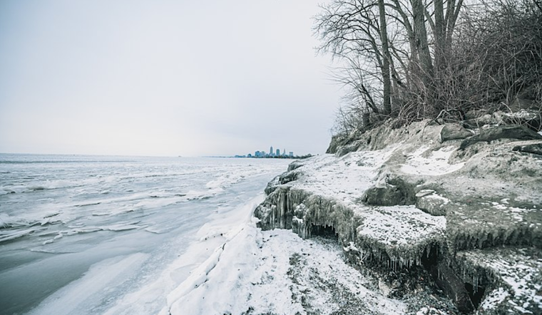
A stark change awaits with the onset of the new week when Arctic high-pressure ushers in bitterly cold air. "Highs on Sunday will climb into the upper teens but by Monday the entire area will not get out of the single digits," according to NWS Cleveland's forecast. Wind chill values during the day could plummet as low as -20F, challenging both residents and infrastructure. Lake effect snow is also in the mix, especially targeting areas in the traditional snowbelt, with further accumulations possible into Monday. The NWS warns that "these temperatures will pose a threat to life and property, especially for vulnerable populations," underscoring the severity of the situation.
The protracted freeze is not merely uncomfortable. It presents tangible risks. "When temperatures fall below 16F for 48 hours of longer, there is an increase risk of impacts to infrastructure," the NWS discussion emphasizes, pointing out concerns such as burst pipes and the enhanced threat of house fires from secondary heating sources. Precautions like insulating pipes, checking on the elderly, bringing pets indoors, and minimizing time spent outdoors become critical to safely navigate this period. Additionally, the NWS reminds us of the practical steps to mitigate these risks, such as keeping pipes warm and being vigilant against carbon monoxide poisoning. With the forecast indicating near -10F temperatures Tuesday night and persistent subzero chills, preparation and caution are the standing orders for Northeast Ohio residents as this deep freeze sets in.
On the maritime front, boaters and mariners are also facing their own set of challenges. The Small Craft Advisory remains in effect until 10 AM today, expected to be reissued later in the evening as strong southerly winds pick up over Lake Erie. The NWS anticipates winds increasing to "20-25 knows from the south-southwest near 7 PM this evening." These conditions will shift with the cold front on Saturday, with the potential for significant wave action and hazardous marine conditions lasting into early next week. Adding to the complexity, the impending cold could lead to rapid ice formation across the lake, creating navigational hazards and the potential for heavy freezing spray in ice-free zones.


.jpg)