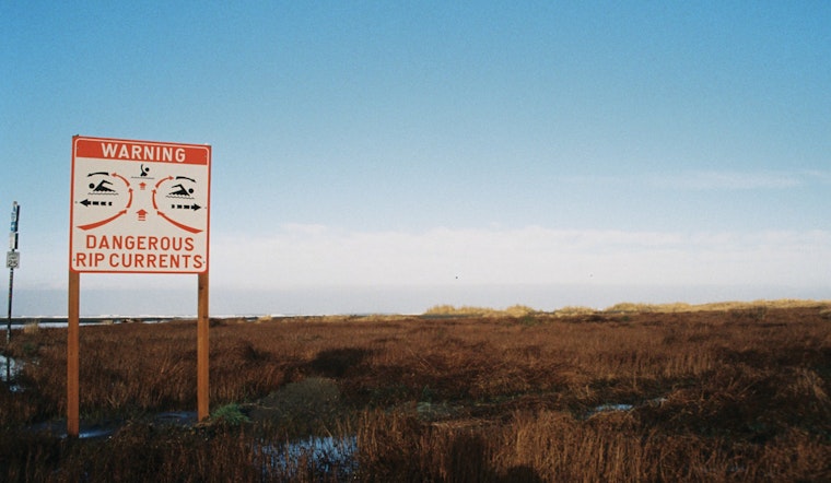
The National Weather Service in Tampa Bay Ruskin has issued a high rip current risk warning effective through Sunday afternoon for multiple counties along the Florida coast. According to the NWS alert, the advisory pertains specifically to Pinellas, Coastal Hillsborough, Coastal Manatee, Coastal Sarasota, Coastal Charlotte, and Coastal Lee Counties.
The Hazardous Weather Conditions highlight the presence of "dangerous rip currents" that could pose a risk to unwary swimmers. Despite overcast skies and a high of 64 degrees in Tampa today, with a northwest wind of 8 to 10 mph, beachgoers are strongly cautioned about the hidden dangers beneath the waves. While humidity remains high at 96%, it is the unseen currents below the water's surface that pose the greatest threat.
The impact of these rip currents is stated to be severe enough to "sweep even the best swimmers away from shore into deeper water," as reported by the National Weather Service. It is highly recommended for individuals to swim near a lifeguard and if caught in a rip current, to "relax and float" instead of swimming against the current. Swimmers are advised to follow the shoreline if able, or signal for help if escape is not possible.
In addition to the rip current warning, the week's forecast for Tampa includes mostly cloudy skies turning to partly sunny by Sunday, with a consistent pattern of cloudiness and slight temperature variations leading into next Friday's sunny projection with a high near 65 degrees. In the evening, clouds tend to gather, cloaking the warmth of the day with cooler temperatures descending to lows in the 40s. Looking ahead to Monday, there's a 20 percent chance for showers after 1pm, seemingly contradictory with the earlier sunny disposition, but this is Florida's weather mosaic we are piecing together.


