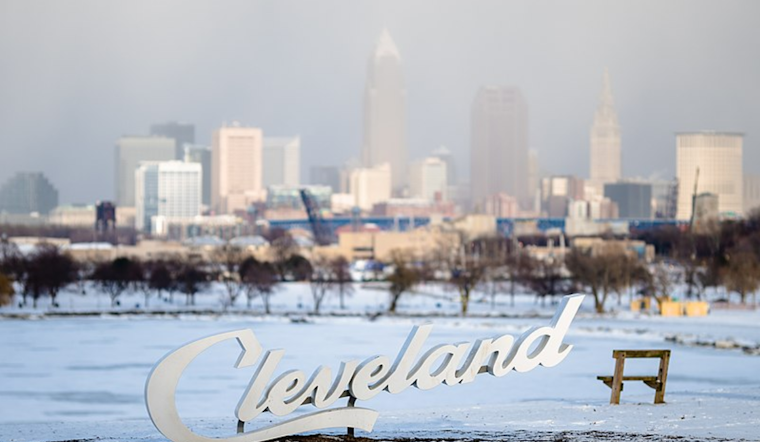
Residents in Northeast Ohio and Northwest Pennsylvania can expect to see light snow showers and minimal accumulation throughout Tuesday, according to the latest forecasts from the National Weather Service (NWS) in Cleveland. The weather pattern, influenced by a lingering trough across the Great Lakes region and a persistent northwest flow, will keep snowfall amounts between 1 to 2 inches in most affected areas. However, the Snowbelt could see slightly higher snow levels, as NWS Cleveland reported on their website.
Temperatures today are expected to rise into the mid to upper 20s with some reprieve from snow showers in the afternoon and early evening due to drier air entering the region. Still, as an upper trough digs south across the Great Lakes tonight, it's likely to reignite lake-effect snow showers, leading to more accumulations through Wednesday. Overnight lows are set to plummet into the teens area-wide, with wind chill values dipping into single digits early Wednesday morning. High temperatures for Wednesday remain in the low to mid-20s. This weather dynamic is not only instigating fresh layers of winter's blanket, but it's ensuring that the chill firmly grips the landscapes' bones.
Looking ahead to Wednesday night through Thursday night, the NWS indicates that a brief Lake Michigan moisture feed will result in a short lake effect snow in the western zones. However, the arrival of high pressure from the lower Ohio Valley will alter wind direction, diminishing most lake effect potential. The northeastern areas of Northwest Pennsylvania are expected to continue experiencing lake effect snow until around 21z Thursday. As high pressure and brief 500mb ridging dry conditions for the remainder of the short-term forecast period into Thursday night, colder temperatures are expected to ravage the region. In some areas, temperatures may dip below zero.
For mariners, the NWS has extended Small Craft Advisories with waves reaching 4-7 feet expected through at least Thursday night for Avon Point east to Ripley, NY. In the western parts of Lake Erie, though advisories end later Tuesday, 1-3ft waves will continue to challenge those on the water. These advisories spotlight the relentless nature of the current weather patterns' influence on both land and lake, signaling that the winter tirade is far from over and precautions on all fronts remain necessary to weather the forthcoming climatic bouts.
The long-term forecast foreshadows a complex low-pressure system potentially resulting in synoptic scale snow for the area towards the end of the week, with the possibility of another clipper system by the end of the weekend. According to the NWS forecast, the cold snap gripping Northeast Ohio and Northwest Pennsylvania seems poised to persist with this anticipated progression.


.jpg)