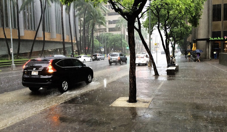
A weather shift is approaching the Hawaiian Islands as a cold front moves in, bringing rainfall across the state. Forecasters expect increasing chances of rain starting today, with the front reaching Kauai tonight before stalling and weakening near Oahu and Molokai by midweek. This weather pattern follows a period of drought and is expected to provide rain, particularly to the dry leeward areas, according to the National Weather Service in Honolulu.
Precipitation began overnight in some parts of Hawaii, with rainfall totals reaching up to a quarter of an inch. The main line of showers is expected to reach Kauai by this evening and Oahu by Wednesday. Southwest winds are also expected to strengthen, potentially reaching 25 knots, which could lead to strong downsloping winds in windward areas before trade winds return later in the week. Rainfall will primarily affect windward and mauka regions. Residents and visitors are advised to prepare for breezy conditions and intermittent showers.
Aviation and marine operations across the islands are expected to be affected. AIRMET advisories have been issued for Mountain Obscuration in several areas, and a Small Craft Advisory is in effect through Thursday due to seas of 10 feet or higher. High surf warnings remain in effect until Thursday evening for north and west-facing shores, as a strong swell continues to produce hazardous surf conditions and the potential for coastal inundation.
Fire weather concerns are expected to be minimal during this period due to the forecasted moisture-rich environment. The moisture, along with the stalled front, is anticipated to interact with a developing low-pressure system aloft, which may lead to locally heavy downpours and isolated thunderstorms later in the week, according to the National Weather Service. As the weather system progresses, high pressure is expected to develop north of the islands, bringing moderate to strong northeast to east trade winds from Wednesday night into Friday. While the weather may pose some immediate hazards, it could also contribute to alleviating drought conditions and replenishing water reserves across the islands.
Residents across the islands are urged to stay informed about the latest weather updates and to exercise caution. The full weather forecast and advisories can be accessed through the NWS Honolulu website.


.jpg)