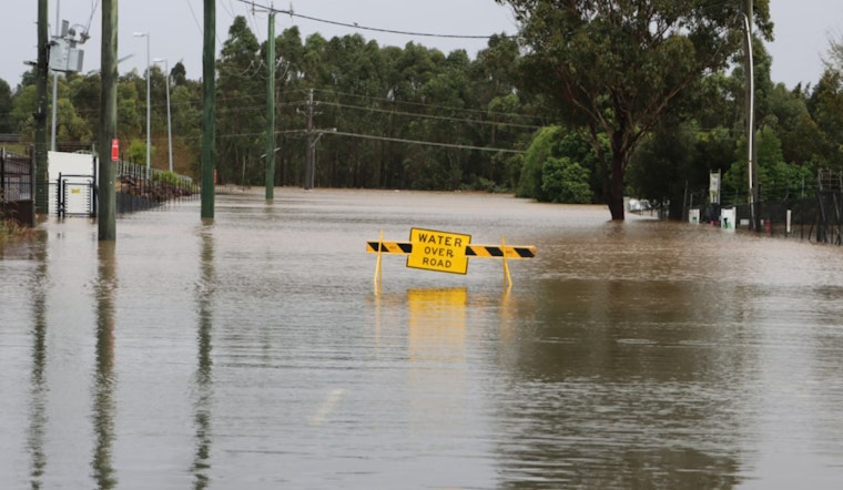
The National Weather Service (NWS) in Memphis has issued a continued flood advisory for the Mississippi River at Memphis and surrounding areas, urging residents and visitors to proceed with caution, especially when walking near riverbanks. The advisory, effectively in place until early Sunday afternoon, warns of flooding caused by excessive rainfall which persists in the region. NWS Memphis details that the current river stage is ominously close to 29 feet, just shy of the action stage which is pegged at 28 feet.
According to the advisory, the Mississippi River is projected to marginally rise to a crest of 28.9 feet by tomorrow morning. The NWS urges the public to absolutely avoid flooded roadways, advising them to instead find an alternative route, a message echoed following updates on the local weather forecast. In Arkansas, the gradual swell of the river has cut off evacuation routes from camps south of Hopefield Chute and threatens to breach levees in multiple locations.
In its detailed forecast, the NWS Memphis anticipates a high near 70 degrees today, with calm winds prevailing in the afternoon and a mostly clear sky by night, suggesting a tranquil pause in the weather's recent restiveness. While Wednesday is expected to be mostly sunny, there is a chance of showers Wednesday night and intermittent chances of precipitation throughout the remainder of the week. The foreseen sunny intervals throughout the weekend may offer some respite before a 30 percent chance of showers and thunderstorms returns on Monday.
For those within the advisory's reach, the NWS stipulates that "caution is urged when walking near riverbanks." The situation along the Mississippi River, particularly at Memphis, is one to be monitored closely given the river's proximity to spilling over established action levels. The impacts of the rising waters have already been felt, as water is now lapping at the levee near Sulcer Road west of South Lake, and touching the levee at Blue Lake. Residents in those areas should stay well-informed and ready to act should conditions significantly worsen.
Finally, with the river levels remaining elevated, it's important for communities to stay current with the latest forecasts and advisories from the NWS. For more detailed information on the outlook and preparedness actions, the public is directed to visit the NWS Memphis website where updates are provided as the situation develops.


