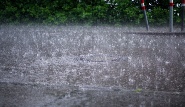
As the weekend's gray skies give way to a patchy rainfall, Sacramento residents can expect a brief interruption to their usual sunny Californian days. The National Weather Service in Sacramento notes a band of light showers moving southeast, hitting regions mainly north of Interstate 80 earlier today. While these are no harbingers for a significant downpour, they do mark a trend of mercurial weather the area has been experiencing lately.
According to the NWS Sacramento latest forecast, "Precipitation amounts so far (230AM) range from a 0.03 hundredths of an inch at Redding Airport to around 0.15 inches in the mountains and foothills of Shasta County." Snow levels stay elevated at around 5000 to 6000 feet, only dropping a dusting at those altitudes, while higher elevations could see 1 to 2 inches of snowfall. These showers are not expected to drench your day, nor significantly increase the Sierra snowpack.
Come Tuesday, the skies will clear up, ushering in dry weather coupled with breezy northerly winds. Temperatures are expected to jump into the low to mid 60s across the Delta and the Valley by the afternoon, with wind gusts reaching 15 to 20 mph. Following this brief respite, another weak system will sweep through the area on Wednesday, bringing chances of light rain primarily north of I-80 and potential snow accumulation above 6000 feet, though, it will be minimal.
The weather storyline shifts significantly as the week progresses. Starting Thursday, the NWS Sacramento's narrative changes tone, forecasting the build-up of a "strong longwave ridge" that will plant itself firmly over the western U.S. through the end of the week. This pressure ridge promises to shut out precipitation and ramp up temperatures well above the norm for this time of year by the weekend. "Probabilities of some readings into the 70s across the Delta, Valley, and foothills by Saturday are around 40 to 75 percent, 50 to 80 percent by Sunday," the NWS highlights. Ensemble guidance bolsters forecasts indicating a dry and warm pattern setting in, affirming what the Climate Prediction Center's 6 to 14 days Outlooks spell out: we're in for above normal temperatures and below normal rainfall.
The outlook for aviators remains optimistic as mostly VFR (Visual Flight Rules) conditions persist across interior Northern California over the next 24 hours. Surface winds are expected to be on the light side, with occasional gusts staying below 12 knots. While the NWS does mention the possibility of local MVFR (Marginal Visual Flight Rules) conditions over mountainous terrains and the Northern Sacramento Valley through 18z, no significant disruptions are expected. Overall, pilots and passengers can anticipate smooth flying conditions as the region transitions between these weather patterns.


