In a direct response to the landscape of California's fire-prone regions, Cal Fire has delivered new, detailed fire hazard severity zone maps. These maps provide essential data with which residents and local authorities can better understand, and thus prepare for, the potential fire threats to their communities. According to KTLA, these maps are constructed using science-based and field-tested models, considering various factors like the probability of fire, potential fuel, and fire behavior.
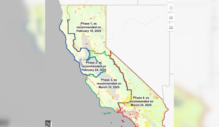
The maps newly released cover the entirety of Southern California, as well as Eastern rural stretches, such as Inyo and Mono counties. This latest release marks the completion of Cal Fire's Phase 4 of Local Responsibility Area data. The first three phases have already enriched the rest of the state with this vital information. Areas are categorized into three levels of hazard: moderate, high, and very high, "Hazard," as clarified by the fire marshal's office, measures the physical conditions contributing to fire likelihood over a substantial period, without considering mitigation measures such as fuel reduction efforts, or home hardening.
These updates come after a significant lapse since the last ones in 2015, a period punctuated by multiple major fires including this year's Palisades and Eaton blazes. NBC Los Angeles reports state officials prioritizing the updates to enhance local governments' land-use decisions, building regulations, and wildfire readiness strategies. The recent fires have underscored the need for such up-to-date maps, with the 2011 Cal Fire map showing Palisades and Malibu as "very high fire hazard severity zones" and closer inspection of places like Altadena revealing varied hazard designations across neighborhoods.


