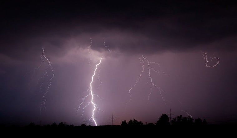
Houston residents are bracing for a series of strong thunderstorms expected to hit the area. A special weather statement released by the National Weather Service outlines a forecast that includes the possibility of hail and tree damage. The early hours of the day already saw severe thunderstorms moving across the city, with a warning including Pasadena, Pearland, and League City effective until 3:30 AM CDT, as reported by NWS Houston. These storms bring the potential for not only significant precipitation but also hail, which could harm vegetation across the Houston region.
According to an update from CW39, the NWS indicated that doppler radar picked up strong thunderstorms early this morning. These storms were spotted along a line extending from Greenway to the Upper Kirby area and were moving quickly at 45 mph. Another line of storms to the southwest might also merge with these, potentially intensifying the situation. Residents are recommended to securely fasten any loose items outside to prevent further damage and to seek immediate shelter if caught outdoors during the storm's passage.
As the city awaits clearing skies by late morning and afternoon, Houston's unpredictable weather is on full display. The National Weather Service forecasts a high near 82°F, with morning clouds gradually clearing, contrasting sharply with the earlier storm warnings.
Houstonians, specifically in Galveston, Fort Bend, Montgomery, Brazoria, Chambers, Liberty, and Harris counties, should take particular precaution, as they will likely be affected throughout the morning. Among the neighborhoods on alert are Jacinto City, Northshore, Scholes Field, and numerous others. "The impact could knock down tree limbs and blow around unsecured objects," as stated by CW39, illustrating that the post-storm cleanup may be significant for some communities. If conditions escalate, advisory updates are expected to be disseminated accordingly.


.jpg)