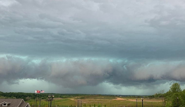
The National Weather Service (NWS) in Nashville has forecasted a string of showers and thunderstorms for the region this week, with varying chances of precipitation on most days. According to the latest update, there's a 70% chance of showers and thunderstorms today, primarily before 11:00 a.m., with possible new rainfall amounts of less than a tenth of an inch, although this could be higher in areas hit by thunderstorms. Wind speeds are expected to range from 10 to 15 mph, accompanied by gusts as high as 25 mph. The temperature could climb to a high near 76 degrees Fahrenheit.
Tonight, the weather is predicted to take a turn for the worse. "Showers and thunderstorms likely, then showers and possibly a thunderstorm after 11pm" are expected, as noted by the NWS update. Some of these storms may be severe, with new rainfall amounts between three-quarters and one inch possible. The chance of precipitation is pegged at a high 90%.
As the week progresses, although the likelihood of storms decreases slightly, the chances of rain remain significant. Monday's forecast points to a 50% chance of showers and thunderstorms, mainly before 1:00 p.m., with mostly cloudy skies and a high near 66 degrees. Moving into Tuesday, conditions slightly improve with mostly sunny skies forecasted and a high approaching 69 degrees.
However, by Wednesday, the chance of showers and thunderstorms reassert themselves, mainly after 1:00 p.m., with a 40% chance of precipitation. The NWS anticipates a high near 83 degrees alongside gusty south winds of 15 to 20 mph, escalating as high as 35 mph. Residents can expect similar conditions through to Saturday, with "showers likely and possibly a thunderstorm," and highs hovering near the 79-degree mark.


