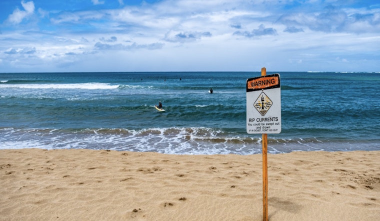
The National Weather Service in Tampa Bay has issued a notice that residents along the coastline should brace themselves for risky conditions. According to the NWS forecast, a high rip current risk is expected to affect areas including Pinellas, Coastal Hillsborough, Coastal Manatee, Coastal Sarasota, Coastal Charlotte, and Coastal Lee from 8 AM EDT this morning through Tuesday evening. The warning makes clear: dangerous rip currents are anticipated, which can pose serious threats to even experienced swimmers.
With humidity standing at 72% and winds hailing from the northwest at a gentle 6 mph, the weather offers deceptively fair skies and cool temperatures that belie the turbulent dangers lurking offshore. The last observation from the National Weather Service was at 5:53 am EDT, underlining a day that will otherwise remain sunny, with highs cresting at a comfortable 74 degrees Fahrenheit. Yet, while the main focus for most would be the comfort of the blue skies above, it is the unseen force beneath the waves that demands vigilance.
For those looking ahead, the week's forecast suggests a gradual warming trend, with temperatures climbing from Wednesday's sunny high of 78, peaking on Saturday at a summery 86 degrees Fahrenheit. Each night is expected to bring clear skies and mild conditions, perfect for those late walks along the bay—provided one stays a respectful distance from the deceptive embrace of the sea.
"Swim near a lifeguard. If caught in a rip current, relax and float. Don't swim against the current. If able, swim in a direction following the shoreline. If unable to escape, face the shore and call or wave for help," according to the NWS Rip Current Statement.


