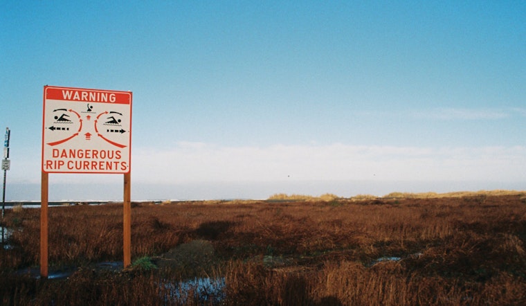
The National Weather Service in Jacksonville has issued a warning that flags a high rip current risk along the Southeast Georgia and Northeast Florida beaches. This risk is reported to be in effect through late Monday night, urging beachgoers to exercise caution. According to the NWS advisory, dangerous rip currents are expected to present a serious hazard to swimmers.
Specific areas highlighted to potentially experience these conditions include Coastal Nassau, Coastal Duval, Coastal Flagler, Northeast Coastal St. Johns, Southeast Coastal St. Johns, Coastal Glynn, and Coastal Camden. Beach visitors are advised to swim near lifeguards and to avoid swimming against the current if caught in a rip current. The NWS statement suggests, "If able, swim in a direction following the shoreline. If unable to escape, face the shore and call or wave for help."
On top of the rip current risk, weather forecasts for the region depict a mix of sunny days interspersed with chances of showers and thunderstorms. Temperatures are expected to soar near 90 degrees today with a 20 percent chance of showers and thunderstorms developing after 3pm, shifting to a northeast wind in the afternoon. According to the NWS forecast, similar patterns with slightly lower temperatures and ongoing chances of rainfall are expected throughout the week.
Monday through Saturday carry anywhere from a 20 to 30 percent chance of showers and thunderstorms, primarily after 4pm and before 7pm, with a dip in temperatures to the low 80s and upper 60s at night. These forecasts underscore the need to equally prepare for warm weather and intermittent bouts of unpredictable rain and storms. As reported by the National Weather Service, "Sunny, with a high near 81," describes Tuesday's forecast, while shifting to "Sunny, with a high near 88," by Thursday.


